Cof Cymru: National Historic Assets of Wales · Wales
Carthouse/Granary at Bodtegir
Llanfihangel Glyn Myfyr, Conwy, Wales
A Grade II listed building in Bodtegir, Llanfihangel Glyn Myfyr, Conwy, designated on 1 April 1998.
The record
- Designation
- Listed building, Grade II
- Broad class
- Agriculture and Subsistence
- Date of designation
- 1 April 1998
- Locality
- Bodtegir
- Community
- Llanfihangel Glyn Myfyr
- Unitary authority
- Conwy
- Country
- Wales
- Coordinates
- 53.02291, -3.48360
- Cadw reference
- 19581
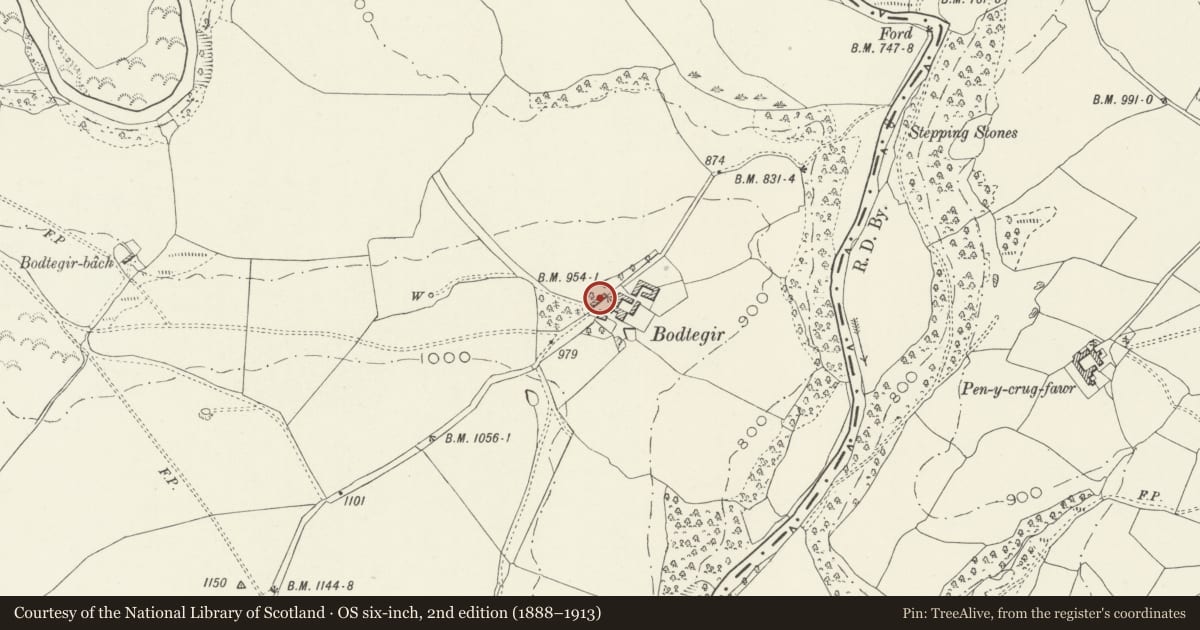
Slide toward Today to fade the historical sheet and see the modern map underneath.
David Rumsey Map Collection, Stanford LibrariesDavid Rumsey Map Collection, Stanford LibrariesLlyfrgell Genedlaethol Cymru – The National Library of WalesDavid Rumsey Map Collection, Stanford LibrariesDavid Rumsey Map Collection, Stanford Libraries
5 historical maps cover this location, the earliest the 1795 map "To Sir Watkin Williams-Wynn Bart ... the map of the six counties of North Wales is most humbly inscribed by his obedient humble servant" (Llyfrgell Genedlaethol Cymru – The National Library of Wales).
Historical maps covering this location
- 1795 · To Sir Watkin Williams-Wynn Bart ... the map of the six counties of North Wales is most… (Llyfrgell Genedlaethol Cymru – The National Library of Wales)
- 1830 · V.3:11-15:XV. Britisches Reich. A. Kon: England. b. Frstenthum Wales: Shire: 37-40 (David Rumsey Map Collection, Stanford Libraries)
- 1883 · Watershed map England, Wales 3. (David Rumsey Map Collection, Stanford Libraries)
- 1898 · 120 Corwen (Hills) (David Rumsey Map Collection, Stanford Libraries)
- 1901 · Sheet 9 and 10. (David Rumsey Map Collection, Stanford Libraries)
Cadw's description
Location
The carthouse/granary is located parallel to and to the NW of the Old Farmhouse.
History
Bodtegir has been a major farm in the area since at least the C17. The carthouse appears to be part of the major rebuilding of the farm buildings, including barn and cowhouses, which took place in the later C18.
Exterior
Built of local stone rubble, with some freestone dressings, and an old slate roof. Three open fronted cart bays, with depressed 3-centred arches of ashlar work on square rubble piers. To the right, a small door leads to the enclosed stair to the granary on the upper floor, which has two shuttered opening lights. A later and lower farm building is attached on the left.
Interior
Two central tensioned king post and strut trusses support the single purlin roof.
Reason for designation
Included as a good example of a larger farm carthouse and for group value with Bodtegir Old Farmhouse.
Nearby in the register
- Bodtegir Old FarmhouseDomesticunder 1 mi
- Maes Cadw Cruck BarnAgriculture and Subsistenceunder 1 mi
- Dolgynlas farmhouse with attached outbuilding rangesAgriculture and Subsistenceunder 1 mi
- Pont LlanfihangelTransport1 mi
Other entries of the same register within about three miles of this one, by straight line.