Cof Cymru: National Historic Assets of Wales · Wales
Mill Office at Cil-cewydd Mill
Forden with Leighton and Trelystan, Powys, Wales
A Grade II listed building in Cil-cewydd, Forden with Leighton and Trelystan, Powys, designated on 20 March 1998.
The record
- Designation
- Listed building, Grade II
- Broad class
- Agriculture and Subsistence
- Date of designation
- 20 March 1998
- Locality
- Cil-cewydd
- Community
- Forden with Leighton and Trelystan
- Unitary authority
- Powys
- Country
- Wales
- Coordinates
- 52.62920, -3.14119
- Cadw reference
- 19558
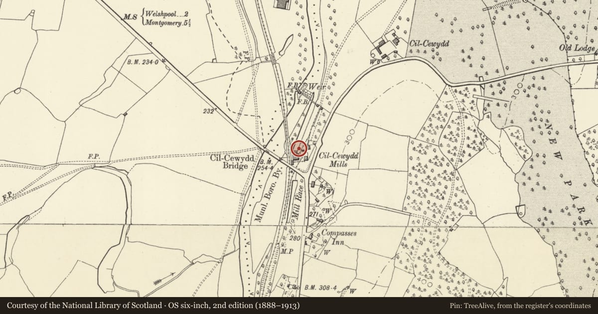
Slide toward Today to fade the historical sheet and see the modern map underneath.
David Rumsey Map Collection, Stanford LibrariesDavid Rumsey Map Collection, Stanford LibrariesDavid Rumsey Map Collection, Stanford LibrariesDavid Rumsey Map Collection, Stanford LibrariesLlyfrgell Genedlaethol Cymru – The National Library of Wales
5 historical maps cover this location, the earliest the 1795 map "To Sir Watkin Williams-Wynn Bart ... the map of the six counties of North Wales is most humbly inscribed by his obedient humble servant" (Llyfrgell Genedlaethol Cymru – The National Library of Wales).
Historical maps covering this location
- 1795 · To Sir Watkin Williams-Wynn Bart ... the map of the six counties of North Wales is most… (Llyfrgell Genedlaethol Cymru – The National Library of Wales)
- 1883 · Watershed map England, Wales 3. (David Rumsey Map Collection, Stanford Libraries)
- 1899 · 151 Welshpool (Hills) (David Rumsey Map Collection, Stanford Libraries)
- 1901 · Sheet 9 and 10. (David Rumsey Map Collection, Stanford Libraries)
- 1916 · Sheet 60. Shrewsbury. (David Rumsey Map Collection, Stanford Libraries)
Cadw's description
Location
At Cil-cewydd Mill, the former mill office stands in the centre of the earlier approach road from the N.
History
Cil-cewydd Mill was the main corn mill for the Leighton Estate; John Naylor, a Liverpool banker, had aquired the Leighton Estate in 1846-47 and embarked on an ambitious programme of building, notably Leighton Hall, church and Leighton Farm. The Estate was extended and improved until Naylor's death in 1889, becoming a remarkable example of high-Victorian estate development. The mill was built for John Naylor in 2 phases, 1862 and 1868, and the office probably dates from the initial build of 1862.
Exterior
Build of red brick in Flemish bond, with rock-faced and margin dressed stone quoins and dressings. Slate roof. Single storeyed, 2 bays. The entrance is in the W gable end; a framed and battened door with overlight under a brick round arch with stone springers and key. Four equally spaced 4-pane sash windows face the approach, and 2 similar windows either side of the central projecting gabled stack on the rear wall. Stone ashlar chimney stack.
Reason for designation
The Leighton Estate is an exceptional example of high-Victorian estate development. It is remarkable for the size and ambition of its conception and planning, the consistency of its design, the extent of its survival, and is the most complete example of its type in Wales. Cil-cewydd Mill is a major industrial complex at the heart of the economic development of the estate, and the office is included as a key component of this well-articulated major corn-mill complex, notable for its ambitious scale.
Nearby in the register
- Cil-cewydd Corn MillIndustrialunder 1 mi
- Outbuilding at Cil-cewydd MillAgriculture and Subsistenceunder 1 mi
- Loading Bay and Weighhouse at Cil-cewydd Corn MillAgriculture and Subsistenceunder 1 mi
- Workman's HutAgriculture and Subsistenceunder 1 mi
Other entries of the same register within about three miles of this one, by straight line.