Cof Cymru: National Historic Assets of Wales · Wales
Pentre Farm
Forden with Leighton and Trelystan, Powys, Wales
A Grade II listed building in Leighton, Forden, Forden with Leighton and Trelystan, Powys, designated on 20 March 1998.
The record
- Designation
- Listed building, Grade II
- Broad class
- Domestic
- Date of designation
- 20 March 1998
- Locality
- Leighton
- Town
- Forden
- Community
- Forden with Leighton and Trelystan
- Unitary authority
- Powys
- Country
- Wales
- Coordinates
- 52.64673, -3.11356
- Cadw reference
- 19498
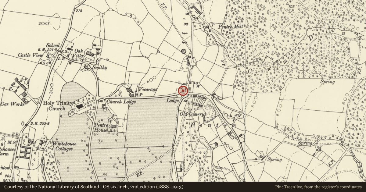
Slide toward Today to fade the historical sheet and see the modern map underneath.
David Rumsey Map Collection, Stanford LibrariesDavid Rumsey Map Collection, Stanford LibrariesDavid Rumsey Map Collection, Stanford LibrariesDavid Rumsey Map Collection, Stanford LibrariesLlyfrgell Genedlaethol Cymru – The National Library of Wales
5 historical maps cover this location, the earliest the 1795 map "To Sir Watkin Williams-Wynn Bart ... the map of the six counties of North Wales is most humbly inscribed by his obedient humble servant" (Llyfrgell Genedlaethol Cymru – The National Library of Wales).
Historical maps covering this location
- 1795 · To Sir Watkin Williams-Wynn Bart ... the map of the six counties of North Wales is most… (Llyfrgell Genedlaethol Cymru – The National Library of Wales)
- 1883 · Watershed map England, Wales 3. (David Rumsey Map Collection, Stanford Libraries)
- 1899 · 151 Welshpool (Hills) (David Rumsey Map Collection, Stanford Libraries)
- 1901 · Sheet 9 and 10. (David Rumsey Map Collection, Stanford Libraries)
- 1916 · Sheet 60. Shrewsbury. (David Rumsey Map Collection, Stanford Libraries)
Cadw's description
Location
Located approximately 0.5km E of Leighton church on N side of a minor road between Leighton and Trelystan and W side of a junction with a private road to Pentre Mill.
Exterior
Early C18, 2-unit lobby entry farmhouse with entrance against the gable end fireplace; one-and-a-half-storeys, of random rubble with slate roof. End brick stack to L, a later lateral brick stack to R front. Two-window front with doorway to L. Dormers and lower storey windows have 2-light casements in wood frames (also an added casement beneath the eaves to R of centre). The doorway has a brick surround with segmental arch and a boarded door, and a gabled hood. Two-storey outshut at the rear has replaced casement windows.
Interior
Not inspected (December 1996) but evidently a 2-unit plan with lobby entry and probably a central, straight stair.
Reason for designation
A well-preserved example of a sub-medieval regional plan type.
Nearby in the register
- Pentre Farm Byre and Cart ShedAgriculture and Subsistenceunder 1 mi
- Offa's Dyke: Section at Pentre FarmLinear Earthworkunder 1 mi
- Offa's Dyke: Pentre SectionLinear Earthworkunder 1 mi
- Pentre HouseDomesticunder 1 mi
Other entries of the same register within about three miles of this one, by straight line.