Cof Cymru: National Historic Assets of Wales · Wales
Boiling house and pigsty at Prysan-fawr
Bodedern, Isle of Anglesey, Wales
A Grade II listed building in Prysan-fawr, Bodedern, Isle of Anglesey, designated on 4 March 1998.
The record
- Designation
- Listed building, Grade II
- Broad class
- Domestic
- Date of designation
- 4 March 1998
- Locality
- Prysan-fawr
- Community
- Bodedern
- Unitary authority
- Isle of Anglesey
- Country
- Wales
- Coordinates
- 53.28156, -4.48158
- Cadw reference
- 19492
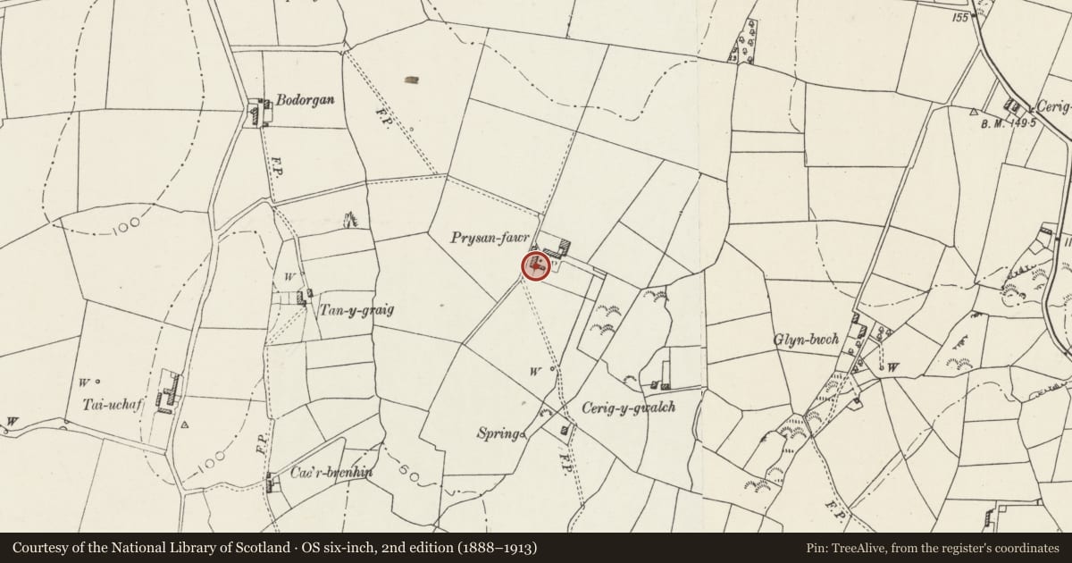
Slide toward Today to fade the historical sheet and see the modern map underneath.
David Rumsey Map Collection, Stanford LibrariesDavid Rumsey Map Collection, Stanford LibrariesDavid Rumsey Map Collection, Stanford LibrariesDavid Rumsey Map Collection, Stanford LibrariesDavid Rumsey Map Collection, Stanford Libraries
5 historical maps cover this location, the earliest the 1883 map "Watershed map England, Wales 3." (David Rumsey Map Collection, Stanford Libraries).
Historical maps covering this location
- 1883 · Watershed map England, Wales 3. (David Rumsey Map Collection, Stanford Libraries)
- 1896 · Sheet 7. Ordnance Survey of England and Wales. (David Rumsey Map Collection, Stanford Libraries)
- 1899 · 93 Holyhead (Hills) (David Rumsey Map Collection, Stanford Libraries)
- 1901 · Sheet 9 and 10. (David Rumsey Map Collection, Stanford Libraries)
- 1919 · Sheet 41. Anglesey. (David Rumsey Map Collection, Stanford Libraries)
Cadw's description
Location
Boiling house and pigsty range forming the S side of the U-plan farmyard at Prysan-fawr.
History
Probably C19 boiling house, later extensions comprise a store-shed and later pigsty.
Exterior
A single storey boiling house, with limewashed rubble walls, and a pitched roof of old small slates, grouted, with an iron skylight. Brick chimney to left (E) gable end. Door to right (W) gable end. Abutting the left (E) gable end is a smaller shed of rubble with a slate roof, with a pigsty at the E end of the range.
Interior
The boiling house is of 2 bays, with a collared truss of sawn timbers. In the E gable is a central brick fireplace with a cast-iron boiler in the corner to the left (N).
Reason for designation
Listed as a well-preserved boiling house, unusual in retaining its cast-iron boiler, which together with the pigsty forms part of a complete farmstead group with Prysan-fawr.
Nearby in the register
- Prysan-fawrDomesticunder 1 mi
- Stable, barn and cowhouse at Prysan-fawrAgriculture and Subsistenceunder 1 mi
- Cowhouse at Prysan-fawrAgriculture and Subsistenceunder 1 mi
- Bodedern Early Christian CemeteryCemeteryunder 1 mi
Other entries of the same register within about three miles of this one, by straight line.