Cof Cymru: National Historic Assets of Wales · Wales
E Precinct Wall at Ewenny Priory (house)
Ewenny, Vale of Glamorgan, Wales
A Grade II* listed building in Ewenny Priory, Ewenny, Vale of Glamorgan, designated on 3 March 1998.
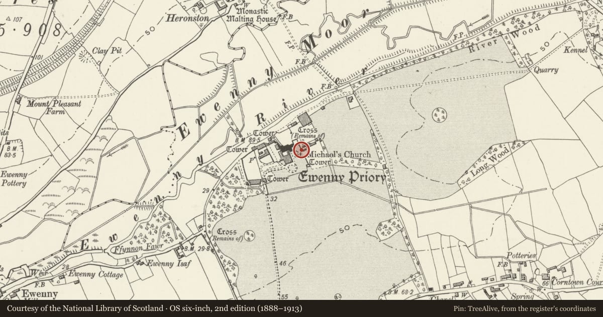
The record
- Designation
- Listed building, Grade II*
- Broad class
- Religious, Ritual and Funerary
- Date of designation
- 3 March 1998
- Locality
- Ewenny Priory
- Community
- Ewenny
- Unitary authority
- Vale of Glamorgan
- Country
- Wales
- Coordinates
- 51.48870, -3.56717
- Cadw reference
- 19465
Slide toward Today to fade the historical sheet and see the modern map underneath.
David Rumsey Map Collection, Stanford LibrariesDavid Rumsey Map Collection, Stanford LibrariesDavid Rumsey Map Collection, Stanford LibrariesDavid Rumsey Map Collection, Stanford LibrariesDavid Rumsey Map Collection, Stanford Libraries
5 historical maps cover this location, the earliest the 1636 map "Cornubia : Devonia, Somersetus, Dorcestria, Wiltonia, Glocestria ..." (David Rumsey Map Collection, Stanford Libraries).
Historical maps covering this location
- 1636 · Cornubia : Devonia, Somersetus, Dorcestria, Wiltonia, Glocestria ... (David Rumsey Map Collection, Stanford Libraries)
- 1637 · The fourth table of England. Cornub. Devonia, Somerset etc. (David Rumsey Map Collection, Stanford Libraries)
- 1865 · England and Wales. England No. 6. (David Rumsey Map Collection, Stanford Libraries)
- 1897 · 262 Pontypridd (Hills) (David Rumsey Map Collection, Stanford Libraries)
- 1897 · 262 Pontypridd (Outline) (David Rumsey Map Collection, Stanford Libraries)
Cadw's description
Location
Aligned roughly N/S in Ewenny Priory (house) garden, joining churchyard at SE and former SE gatehouse.
History
Main E section believed to be part of the early precinct wall dating from soon after foundation of Priory in C12, not remodelled and strengthened like the W sections in C13. Incorporates original C12 W doorway of Priory Church re-set as garden gate in early C19 (separately listed). NE return is post Dissolution probably relating to enclosure of Ewenny Priory (house) grounds in early C19.
Exterior
Main section is a straight stretch of wall joining the former SE gatehouse later converted to columbarium and SE corner of Priory churchyard. Of stone rubble with 2 rows of putlogs. At NE it forms the E wall of an enclosure which is the private cemetery of the Picton Turbervill family, occupiers of Ewenny Priory (house). The return NE bordering the N side of the private cemetery and the S side of the churchyard has battlements incorporating arrow loops, wall walk, all on a much smaller scale than W of church, with a low stretch of footing joining ruined N transept at NE corner.
Reason for designation
Listed II* as probably the earliest stretch of precinct wall although not as elaborate as the later W rebuild; group value with the other buildings of Ewenny Priory, in particular Ewenny Priory Church and SE Tower.
Scheduled Ancient Monument Gm 190 (part).
Nearby in the register
- Romanesque gateway in former E precinct wall at Ewenny Priory (house)Religious, Ritual and Funeraryunder 1 mi
- Ewenny Priory ChurchReligious, Ritual and Funeraryunder 1 mi
- Church of St MichaelReligious, Ritual and Funeraryunder 1 mi
- Ewenny Priory (house)Domesticunder 1 mi
Other entries of the same register within about three miles of this one, by straight line.