Cof Cymru: National Historic Assets of Wales · Wales
Garden wall linking N and S Gatehouses at Ewenny Priory (house)
Ewenny, Vale of Glamorgan, Wales
A Grade II listed building in Ewenny Priory, Ewenny, Vale of Glamorgan, designated on 3 March 1998.
The record
- Designation
- Listed building, Grade II
- Broad class
- Gardens, Parks and Urban Spaces
- Date of designation
- 3 March 1998
- Locality
- Ewenny Priory
- Community
- Ewenny
- Unitary authority
- Vale of Glamorgan
- Country
- Wales
- Coordinates
- 51.48822, -3.56900
- Cadw reference
- 19464
Slide toward Today to fade the historical sheet and see the modern map underneath.
David Rumsey Map Collection, Stanford LibrariesDavid Rumsey Map Collection, Stanford LibrariesDavid Rumsey Map Collection, Stanford LibrariesDavid Rumsey Map Collection, Stanford LibrariesDavid Rumsey Map Collection, Stanford Libraries
5 historical maps cover this location, the earliest the 1636 map "Cornubia : Devonia, Somersetus, Dorcestria, Wiltonia, Glocestria ..." (David Rumsey Map Collection, Stanford Libraries).
Historical maps covering this location
- 1636 · Cornubia : Devonia, Somersetus, Dorcestria, Wiltonia, Glocestria ... (David Rumsey Map Collection, Stanford Libraries)
- 1637 · The fourth table of England. Cornub. Devonia, Somerset etc. (David Rumsey Map Collection, Stanford Libraries)
- 1865 · England and Wales. England No. 6. (David Rumsey Map Collection, Stanford Libraries)
- 1897 · 262 Pontypridd (Hills) (David Rumsey Map Collection, Stanford Libraries)
- 1897 · 262 Pontypridd (Outline) (David Rumsey Map Collection, Stanford Libraries)
Cadw's description
Location
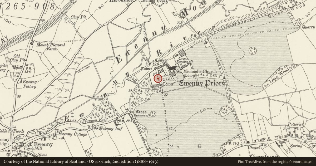
Adjoining inner faces of N and S gatehouses and forming the 4th side of the walled garden within Ewenny Priory grounds.
History
Garden wall built c 1812, part of the remodelling of house and grounds in the early C19.
Exterior
A straight stretch of wall aligned N/S which together with the medieval precinct walls N, W and S creates a roughly rectangular walled enclosure. Rubble wall with overhanging slab coping and 2 segmental arched doorways.
Reason for designation
Included for its interest as part of the early C19 landscaping roughly contemporary with the remodelling of the main house; group value with other buildings of Ewenny Priory, especially the Precinct Walls and the N and S Gatehouses.
Nearby in the register
- Medieval fishpool in W part of Ewenny Priory (house) gardensReligious, Ritual and Funeraryunder 1 mi
- S Gatehouse at Ewenny Priory (house)Religious, Ritual and Funeraryunder 1 mi
- W Precinct Wall at Ewenny Priory (house)Religious, Ritual and Funeraryunder 1 mi
- Stable Court W Range at Ewenny Priory (house)Domesticunder 1 mi
Other entries of the same register within about three miles of this one, by straight line.