Cof Cymru: National Historic Assets of Wales · Wales
Garden Gates at Cefnamwlch
Tudweiliog, Gwynedd, Wales
A Grade II listed building in Cefnamwlch, Pwllheli, Tudweiliog, Gwynedd, designated on 2 March 1998.
The record
- Designation
- Listed building, Grade II
- Broad class
- Domestic
- Date of designation
- 2 March 1998
- Locality
- Cefnamwlch
- Town
- Pwllheli
- Community
- Tudweiliog
- Unitary authority
- Gwynedd
- Country
- Wales
- Coordinates
- 52.88607, -4.62664
- Cadw reference
- 19434
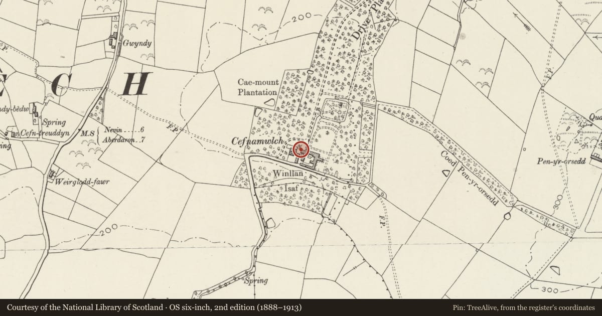
Slide toward Today to fade the historical sheet and see the modern map underneath.
David Rumsey Map Collection, Stanford LibrariesDavid Rumsey Map Collection, Stanford LibrariesDavid Rumsey Map Collection, Stanford LibrariesDavid Rumsey Map Collection, Stanford LibrariesDavid Rumsey Map Collection, Stanford Libraries
5 historical maps cover this location, the earliest the 1608 map "(13) Cambriae Typus." (David Rumsey Map Collection, Stanford Libraries).
Historical maps covering this location
- 1608 · (13) Cambriae Typus. (David Rumsey Map Collection, Stanford Libraries)
- 1830 · V.3:11-15:XV. Britisches Reich. A. Kon: England. b. Frstenthum Wales: Shire: 37-40 (David Rumsey Map Collection, Stanford Libraries)
- 1883 · Watershed map England, Wales 3. (David Rumsey Map Collection, Stanford Libraries)
- 1899 · 134 Pwllheli (Hills) (David Rumsey Map Collection, Stanford Libraries)
- 1901 · Sheet 9 and 10. (David Rumsey Map Collection, Stanford Libraries)
Cadw's description
Location
Situated at the N end and to the W of the barn range at Cefnamwlch.
History
Wrought iron gates to enclosure to rear of the barn at Cefn Amwlch, possibly early C19 and perhaps reset here.
Exterior
Pair of large wrought iron gates, perhaps reset, between plain squared stone piers. Scroll-work in lower part, then closely-set rails with mid-rail of roundels above mid-height. Scrolled spearheads over top-rail flanking centre wrought iron fleur-de-lys.
Reason for designation
Included for group value with barn range, and as fine ironwork.
Nearby in the register
- Gatehouse at CefnamwlchDomesticunder 1 mi
- Coach House at CefnamwlchDomesticunder 1 mi
- Mounting Block at CefnamwlchDomesticunder 1 mi
- Barn Range at CefnamwlchAgriculture and Subsistenceunder 1 mi
Other entries of the same register within about three miles of this one, by straight line.