Cof Cymru: National Historic Assets of Wales · Wales
High Toch Farmhouse
Slebech, Pembrokeshire, Wales
A Grade II listed building in Toch Wood, Slebech, Pembrokeshire, designated on 26 February 1998.
The record
- Designation
- Listed building, Grade II
- Broad class
- Agriculture and Subsistence
- Date of designation
- 26 February 1998
- Locality
- Toch Wood
- Community
- Slebech
- Unitary authority
- Pembrokeshire
- Country
- Wales
- Coordinates
- 51.79837, -4.82302
- Cadw reference
- 19418
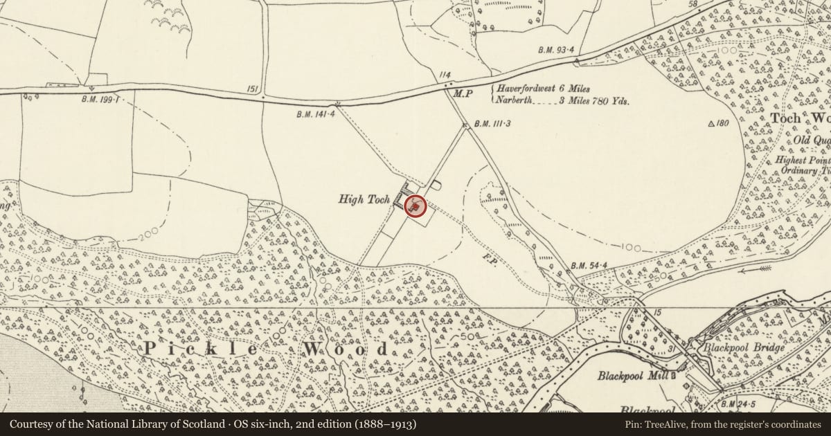
Slide toward Today to fade the historical sheet and see the modern map underneath.
David Rumsey Map Collection, Stanford LibrariesDavid Rumsey Map Collection, Stanford LibrariesDavid Rumsey Map Collection, Stanford LibrariesDavid Rumsey Map Collection, Stanford LibrariesDavid Rumsey Map Collection, Stanford Libraries
5 historical maps cover this location, the earliest the 1636 map "Cornubia : Devonia, Somersetus, Dorcestria, Wiltonia, Glocestria ..." (David Rumsey Map Collection, Stanford Libraries).
Historical maps covering this location
- 1636 · Cornubia : Devonia, Somersetus, Dorcestria, Wiltonia, Glocestria ... (David Rumsey Map Collection, Stanford Libraries)
- 1830 · V.3:11-15:XV. Britisches Reich. A. Kon: England. b. Frstenthum Wales: Shire: 37-40 (David Rumsey Map Collection, Stanford Libraries)
- 1891 · Sheet 10. Ordnance Survey of England and Wales. . (David Rumsey Map Collection, Stanford Libraries)
- 1898 · 228 Haverfordwest (Hills) (David Rumsey Map Collection, Stanford Libraries)
- 1901 · Sheet 13. (David Rumsey Map Collection, Stanford Libraries)
Cadw's description
Location
S of A40(T) 1.5 km W of Canaston Bridge
History
Early C19 farmhouse, within the Picton estate. In 1841 it was occupied by John Rees but in 1846 by George Bowen; both farmers.
Exterior
Symmetrical front facing S to a lawned area with hedges. Two storeys, three windows; late C19 sash windows of 4 panes with exposed frames. Slate hanging on front elevation, with slightly diminishing courses. Sides and rear in uncoursed limestone rubble with selected larger stones for the quoins. Slated roof. End chimneys to the front range; the chimney at left serves the kitchen.
The house is of double-pile plan, with two gables appearing on side elevations. The front span is greater and higher than the rear. Twelve-pane sash-windows survive in the E elevation in both front and rear units. Small walled yard at rear.
Reason for designation
Listed as a good early C19 vernacular farmhouse with slate-hanging.
Nearby in the register
- Milepost near High Toch FarmTransportunder 1 mi
- Blackpool BridgeTransportunder 1 mi
- Blackpool BridgeTransportunder 1 mi
- Blackpool MillIndustrialunder 1 mi
Other entries of the same register within about three miles of this one, by straight line.