Cof Cymru: National Historic Assets of Wales · Wales
Gates of Baptist Chapel
Slebech, Pembrokeshire, Wales
A Grade II listed building in South Dairy Mountain, Slebech, Pembrokeshire, designated on 26 February 1998.
The record
- Designation
- Listed building, Grade II
- Broad class
- Religious, Ritual and Funerary
- Date of designation
- 26 February 1998
- Locality
- South Dairy Mountain
- Community
- Slebech
- Unitary authority
- Pembrokeshire
- Country
- Wales
- Coordinates
- 51.80812, -4.90096
- Cadw reference
- 19417
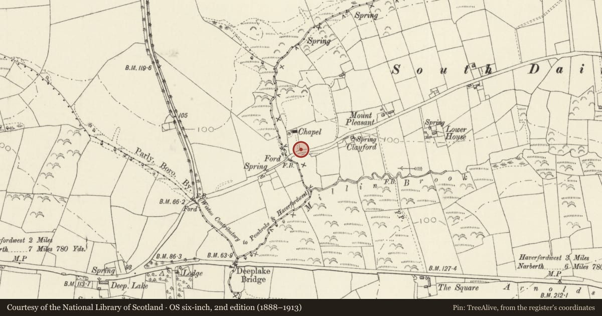
Slide toward Today to fade the historical sheet and see the modern map underneath.
David Rumsey Map Collection, Stanford LibrariesDavid Rumsey Map Collection, Stanford LibrariesDavid Rumsey Map Collection, Stanford LibrariesDavid Rumsey Map Collection, Stanford LibrariesDavid Rumsey Map Collection, Stanford Libraries
5 historical maps cover this location, the earliest the 1608 map "(13) Cambriae Typus." (David Rumsey Map Collection, Stanford Libraries).
Historical maps covering this location
- 1608 · (13) Cambriae Typus. (David Rumsey Map Collection, Stanford Libraries)
- 1636 · Cornubia : Devonia, Somersetus, Dorcestria, Wiltonia, Glocestria ... (David Rumsey Map Collection, Stanford Libraries)
- 1891 · Sheet 10. Ordnance Survey of England and Wales. . (David Rumsey Map Collection, Stanford Libraries)
- 1898 · 228 Haverfordwest (Hills) (David Rumsey Map Collection, Stanford Libraries)
- 1901 · Sheet 13. (David Rumsey Map Collection, Stanford Libraries)
Cadw's description
Location
At the entrance to the graveyard of the Baptist chapel, reached by a minor road from Deeplake to South Dairy Mountain, to the N of the A40(T).
History
Gates forged for Bethesda Chapel, Haverfordwest, c.1830, and re-installed in this location c.1879. Other fittings for the chapel were acquired from Bethesda at the same date.
Exterior
A pair of lightly constructed wrought iron gates, hung on stone piers. The name 'Bethesda' is worked into the cresting. The decorative treatment consists largely of repeated scrolls.
Reason for designation
Listed as wrought-ironwork of c.1830 and for group value with the chapel.
Nearby in the register
- Zion Baptist ChapelReligious, Ritual and Funeraryunder 1 mi
- Moat NW of Merryborough FarmMoated Siteunder 1 mi
- Good Hook Round BarrowRound Barrowunder 1 mi
- Woodbarn CampRath1 mi
Other entries of the same register within about three miles of this one, by straight line.