Cof Cymru: National Historic Assets of Wales · Wales
Deer Park Wall
Marloes and St. Brides, Pembrokeshire, Wales
A Grade II listed building in Martin's Haven, Haverfordwest, Marloes and St. Brides, Pembrokeshire, designated on 23 February 1998.
The record
- Designation
- Listed building, Grade II
- Broad class
- Gardens, Parks and Urban Spaces
- Date of designation
- 23 February 1998
- Locality
- Martin's Haven
- Town
- Haverfordwest
- Community
- Marloes and St. Brides
- Unitary authority
- Pembrokeshire
- Country
- Wales
- Coordinates
- 51.73437, -5.24513
- Cadw reference
- 19404
Slide toward Today to fade the historical sheet and see the modern map underneath.
David Rumsey Map Collection, Stanford LibrariesDavid Rumsey Map Collection, Stanford LibrariesDavid Rumsey Map Collection, Stanford LibrariesDavid Rumsey Map Collection, Stanford LibrariesDavid Rumsey Map Collection, Stanford Libraries
5 historical maps cover this location, the earliest the 1608 map "(13) Cambriae Typus." (David Rumsey Map Collection, Stanford Libraries).
Historical maps covering this location
- 1608 · (13) Cambriae Typus. (David Rumsey Map Collection, Stanford Libraries)
- 1636 · Cornubia : Devonia, Somersetus, Dorcestria, Wiltonia, Glocestria ... (David Rumsey Map Collection, Stanford Libraries)
- 1898 · 227 Milford (Hills) (David Rumsey Map Collection, Stanford Libraries)
- 1898 · 227 Milford (Outline) (David Rumsey Map Collection, Stanford Libraries)
- 1901 · Sheet 13. (David Rumsey Map Collection, Stanford Libraries)
Cadw's description
Location
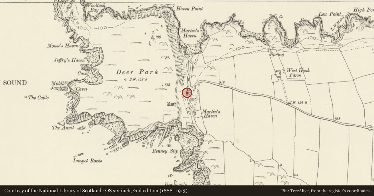
Running S from Martin's Haven to the sea at Renny Slip, enclosing the former Deer Park to the W.
History
Enclosing wall of a deer park of uncertain date possibly C18 or early C19. A Deer Park of 57 acres (23 hectares) is marked on the Tithe Map of 1845 owned by William Philipps of St Brides Casle. The wall separates the headland at Martin's Haven from the mainland.
Exterior
Long rubble stone deer-park wall with rough stone coping running for some 450m metres between Martin's Haven on the N and Renney's Slip on the S. Wall is some two to three metres high. Cottages (now converted to conveniences and exhibition area) built behind at Martin's Haven and niche made adjoining to display cross-inscribed stone found nearby in the 1980s.
Reason for designation
Included as a landscape feature of historical significance in a magnificent coastal area.
Nearby in the register
- Martin's Haven Early Christian Inscribed CrossCross-marked stoneunder 1 mi
- Deer Park Promontory FortPromontory Fort - coastalunder 1 mi
- West HookDomesticunder 1 mi
- Watery Bay RathPromontory Fort - coastalunder 1 mi
Other entries of the same register within about three miles of this one, by straight line.