Cof Cymru: National Historic Assets of Wales · Wales
Pair of Williams Chest Tombs in the churchyard of the Church of St Mary Magdalene
Cerrigydrudion, Conwy, Wales
A Grade II listed building in Cerrigydrudion, Conwy, designated on 17 February 1998.
The record
- Designation
- Listed building, Grade II
- Broad class
- Religious, Ritual and Funerary
- Date of designation
- 17 February 1998
- Locality
- Cerrigydrudion
- Community
- Cerrigydrudion
- Unitary authority
- Conwy
- Country
- Wales
- Coordinates
- 53.02557, -3.56241
- Cadw reference
- 19345
Slide toward Today to fade the historical sheet and see the modern map underneath.
David Rumsey Map Collection, Stanford LibrariesDavid Rumsey Map Collection, Stanford LibrariesLlyfrgell Genedlaethol Cymru – The National Library of WalesDavid Rumsey Map Collection, Stanford LibrariesDavid Rumsey Map Collection, Stanford Libraries
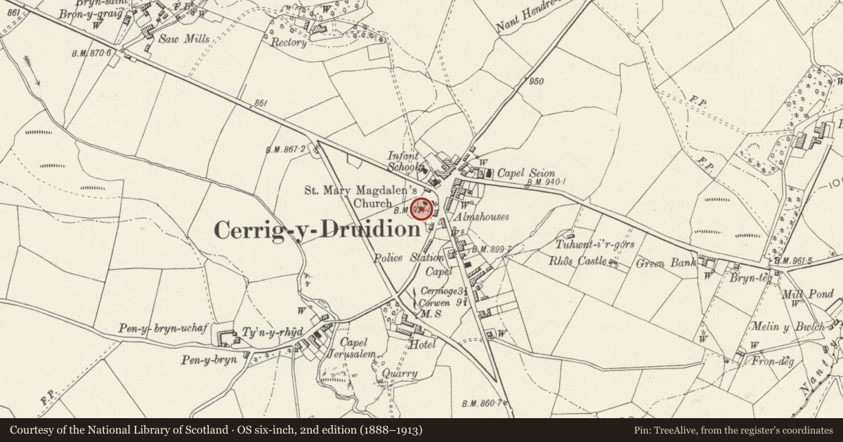
5 historical maps cover this location, the earliest the 1795 map "To Sir Watkin Williams-Wynn Bart ... the map of the six counties of North Wales is most humbly inscribed by his obedient humble servant" (Llyfrgell Genedlaethol Cymru – The National Library of Wales).
Historical maps covering this location
- 1795 · To Sir Watkin Williams-Wynn Bart ... the map of the six counties of North Wales is most… (Llyfrgell Genedlaethol Cymru – The National Library of Wales)
- 1830 · V.3:11-15:XV. Britisches Reich. A. Kon: England. b. Frstenthum Wales: Shire: 37-40 (David Rumsey Map Collection, Stanford Libraries)
- 1883 · Watershed map England, Wales 3. (David Rumsey Map Collection, Stanford Libraries)
- 1898 · 120 Corwen (Hills) (David Rumsey Map Collection, Stanford Libraries)
- 1901 · Sheet 9 and 10. (David Rumsey Map Collection, Stanford Libraries)
Cadw's description
Location
The chest tombs are set side by side in the churchyard, at the SW corner of the church porch.
History
Erected in the mid and later C19.
Exterior
Constructed completely of blue slate. From the S: (a) the sides fielded and panelled with inward radiused corners, set between twisted corner columns. The edge-moulded ledger is inscribed to Jane, wife of Robert Williams, Cummein, who died 1872 aged 38; other members of the family added later. (b) a similar and slightly taller chest tomb, but with plain corner columns, and inscribed at length to Hugh, son of William Jones, Bant-y-Griafolen a Gladdwyd, d.1823, his wife Jane, d.1832 and other family members added.
Reason for designation
Included for group value with the Church of St Mary Magdalene, near the south door of which these monuments are conspicuously placed.
Nearby in the register
- Church of St Mary MagdaleneReligious, Ritual and Funeraryunder 1 mi
- Table Tomb in the churchyard of the Church of St Mary MagdaleneReligious, Ritual and Funeraryunder 1 mi
- Morris Monument in the churchyard of the Church of St Mary MagdaleneReligious, Ritual and Funeraryunder 1 mi
- Hafan Prys AlmshousesHealth and Welfareunder 1 mi
Other entries of the same register within about three miles of this one, by straight line.