Cof Cymru: National Historic Assets of Wales · Wales
Cerrigydrudion War Memorial
Cerrigydrudion, Conwy, Wales
A Grade II listed building in Cerrigydrudion, Conwy, designated on 17 February 1998.
The record
- Designation
- Listed building, Grade II
- Broad class
- Commemorative
- Date of designation
- 17 February 1998
- Locality
- Cerrigydrudion
- Town
- Cerrigydrudion
- Community
- Cerrigydrudion
- Unitary authority
- Conwy
- Country
- Wales
- Coordinates
- 53.02623, -3.56124
- Cadw reference
- 19343
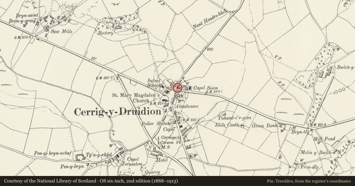
Slide toward Today to fade the historical sheet and see the modern map underneath.
David Rumsey Map Collection, Stanford LibrariesDavid Rumsey Map Collection, Stanford LibrariesLlyfrgell Genedlaethol Cymru – The National Library of WalesDavid Rumsey Map Collection, Stanford LibrariesDavid Rumsey Map Collection, Stanford Libraries
5 historical maps cover this location, the earliest the 1795 map "To Sir Watkin Williams-Wynn Bart ... the map of the six counties of North Wales is most humbly inscribed by his obedient humble servant" (Llyfrgell Genedlaethol Cymru – The National Library of Wales).
Historical maps covering this location
- 1795 · To Sir Watkin Williams-Wynn Bart ... the map of the six counties of North Wales is most… (Llyfrgell Genedlaethol Cymru – The National Library of Wales)
- 1830 · V.3:11-15:XV. Britisches Reich. A. Kon: England. b. Frstenthum Wales: Shire: 37-40 (David Rumsey Map Collection, Stanford Libraries)
- 1883 · Watershed map England, Wales 3. (David Rumsey Map Collection, Stanford Libraries)
- 1898 · 120 Corwen (Hills) (David Rumsey Map Collection, Stanford Libraries)
- 1901 · Sheet 9 and 10. (David Rumsey Map Collection, Stanford Libraries)
Cadw's description
Location
The memorial stands at the N end of the central square, outside Lloyds Bank, and at the junction of the Llyn Brenig and Llanfihangel Roads.
History
Erected probably 1919-1920 as a memorial to those of the parish lost in the Great War.
Exterior
Built of grey granite. A tall stele set on a rectangular block plinth raised over 3 steps. The shaft has a gabled top with egg and dart mouldings below the front. The front panel is raised and is inscribed, below a wreath, with the names of seven soldiers of the parish fallen in the Great War, with a further four killed whilst on active service. At the base, a further panel in a similar material has been added recording a further four names of those lost in 1939-1945. The whole monument is set within an area enclosed with low steel railings.
Reason for designation
Included as a well proportioned and prominently sited war memorial, of importance to the history of the locality.
Nearby in the register
- Hafan Prys AlmshousesHealth and Welfareunder 1 mi
- Morris Monument in the churchyard of the Church of St Mary MagdaleneReligious, Ritual and Funeraryunder 1 mi
- Church of St Mary MagdaleneReligious, Ritual and Funeraryunder 1 mi
- Table Tomb in the churchyard of the Church of St Mary MagdaleneReligious, Ritual and Funeraryunder 1 mi
Other entries of the same register within about three miles of this one, by straight line.