Cof Cymru: National Historic Assets of Wales · Wales
Efail Pont y Gof
Botwnnog, Gwynedd, Wales
A Grade II listed building in Botwnnog, Pwllheli, Gwynedd, designated on 11 February 1998.
The record
- Designation
- Listed building, Grade II
- Broad class
- Domestic
- Date of designation
- 11 February 1998
- Locality
- Botwnnog
- Town
- Pwllheli
- Community
- Botwnnog
- Unitary authority
- Gwynedd
- Country
- Wales
- Coordinates
- 52.85053, -4.58869
- Cadw reference
- 19332
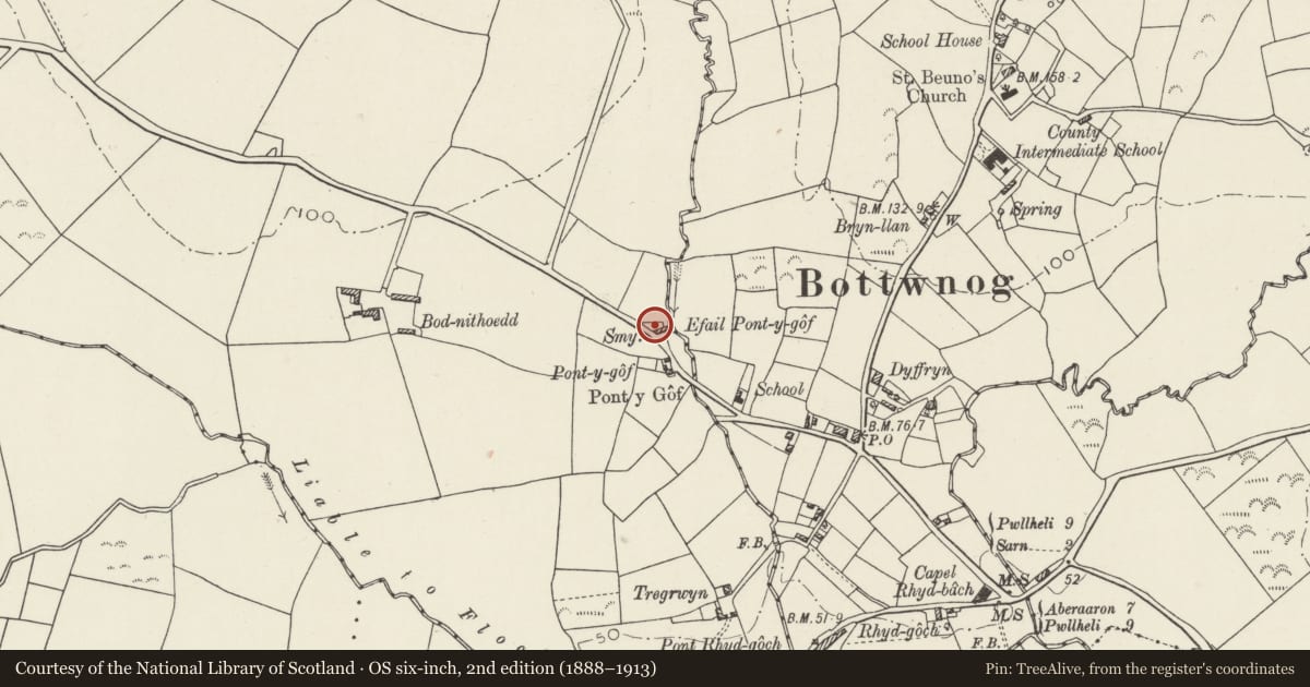
Slide toward Today to fade the historical sheet and see the modern map underneath.
David Rumsey Map Collection, Stanford LibrariesDavid Rumsey Map Collection, Stanford LibrariesDavid Rumsey Map Collection, Stanford LibrariesDavid Rumsey Map Collection, Stanford LibrariesDavid Rumsey Map Collection, Stanford Libraries
5 historical maps cover this location, the earliest the 1608 map "(13) Cambriae Typus." (David Rumsey Map Collection, Stanford Libraries).
Historical maps covering this location
- 1608 · (13) Cambriae Typus. (David Rumsey Map Collection, Stanford Libraries)
- 1830 · V.3:11-15:XV. Britisches Reich. A. Kon: England. b. Frstenthum Wales: Shire: 37-40 (David Rumsey Map Collection, Stanford Libraries)
- 1883 · Watershed map England, Wales 3. (David Rumsey Map Collection, Stanford Libraries)
- 1899 · 134 Pwllheli (Hills) (David Rumsey Map Collection, Stanford Libraries)
- 1901 · Sheet 9 and 10. (David Rumsey Map Collection, Stanford Libraries)
Cadw's description
Location
N of the roadside next to a bend in the B4413 road at the W end of Botwnnog village.
History
A croglofft cottage and adjoining smithy, probably dating from the early C19, built in a single range.
Exterior
Squared rubble stone; laid in big coursed blocks. Roof of small slates laid in diminishing courses; stone end-stacks, caps have simple oversailing course and water tabling at base. Single-storey cottage is whitewashed, symmetrical S front with boarded and half-glazed door in centre, flanked either side by 16-pane sashes, thin slate sills. Small single-light window to loft in E gable. Smithy has door in two halves and, to left, window with 10-pane upper light, boarded below. Stone lean-to attached to W gable has a similar sized opening (now blocked) with iron rail.
Interior
Cottage entry direct into kitchen; ceiling floored at the collar. Earth floor (now largely concreted); blocked fireplace opening, side cupboard. Central boarded partition with door to downstairs bedroom. Above, in upper partition, door to croggloft. Inside smithy, the forge has been removed. Another doorway in back wall opposite entry creates through-passage. Interior of lean-to, now empty, formerly housed bellows.
Reason for designation
A well-preserved croglofft cottage and smithy; now rare and historically important examples of Welsh regional vernacular architecture, retaining early character and detail.
Nearby in the register
- Pont Rhyd-gochTransportunder 1 mi
- Old SchoolEducationunder 1 mi
- Church of St BeunoReligious, Ritual and Funeraryunder 1 mi
- Bridge at TrewenTransportunder 1 mi
Other entries of the same register within about three miles of this one, by straight line.