Cof Cymru: National Historic Assets of Wales · Wales
Cross in Churchyard of Church of St David.
Llantilio Pertholey, Monmouthshire, Wales
A Grade II listed building in Llanddewi-Skirrid, Abergavenny, Llantilio Pertholey, Monmouthshire, designated on 5 February 1998.
The record
- Designation
- Listed building, Grade II
- Broad class
- Religious, Ritual and Funerary
- Date of designation
- 5 February 1998
- Locality
- Llanddewi-Skirrid
- Town
- Abergavenny
- Community
- Llantilio Pertholey
- Unitary authority
- Monmouthshire
- Country
- Wales
- Coordinates
- 51.84816, -2.95826
- Cadw reference
- 19314
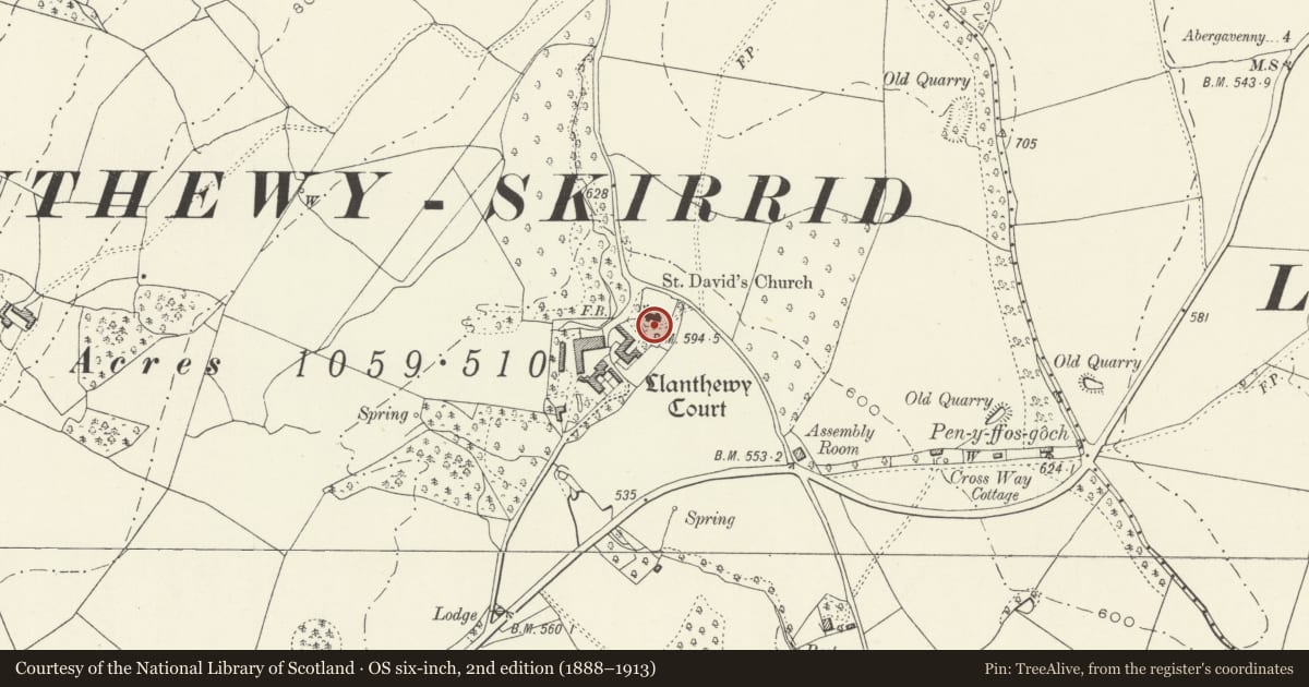
Slide toward Today to fade the historical sheet and see the modern map underneath.
David Rumsey Map Collection, Stanford LibrariesDavid Rumsey Map Collection, Stanford LibrariesDavid Rumsey Map Collection, Stanford LibrariesDavid Rumsey Map Collection, Stanford LibrariesDavid Rumsey Map Collection, Stanford Libraries
5 historical maps cover this location, the earliest the 1636 map "Cornubia : Devonia, Somersetus, Dorcestria, Wiltonia, Glocestria ..." (David Rumsey Map Collection, Stanford Libraries).
Historical maps covering this location
- 1636 · Cornubia : Devonia, Somersetus, Dorcestria, Wiltonia, Glocestria ... (David Rumsey Map Collection, Stanford Libraries)
- 1895 · Sheet 11. Ordnance Survey of England and Wales. (David Rumsey Map Collection, Stanford Libraries)
- 1898 · 232 Abergavenny (Hills) (David Rumsey Map Collection, Stanford Libraries)
- 1898 · 232 Abergavenny (Outline) (David Rumsey Map Collection, Stanford Libraries)
- 1901 · Sheet 14. (David Rumsey Map Collection, Stanford Libraries)
Cadw's description
Location
About 10m south of Church of St David.
History
Late medieval, probably C15, churchyard cross now broken and fragmentary.
Exterior
Sandstone. The socket stone rests directly on the ground as far as can be seen. It is square/octagonal with incised stops, but very worn, probably broached (otherwise bull-nosed). The shaft rises approximately 1m and is broken off; octagonal with pyramid stops to the base. A wheel-head cross is broken off and rests beside the shaft. This is of the same stone but may not be from the same cross.
Reason for designation
Included as an example of a medieval churchyard cross which also has group value with the Church of St David.
Nearby in the register
- Church of St DavidReligious, Ritual and Funeraryunder 1 mi
- Parish Hall at Llanddewi-SkirridReligious, Ritual and Funeraryunder 1 mi
- Barn Range at Wern-y-cwmAgriculture and Subsistenceunder 1 mi
- Wern-y-cwm FarmhouseDomesticunder 1 mi
Other entries of the same register within about three miles of this one, by straight line.