Cof Cymru: National Historic Assets of Wales · Wales
Small Barn east of Pont Rhys Powell Farm
Crucorney, Monmouthshire, Wales
A Grade II listed building in Cwmyoy, Abergavenny, Crucorney, Monmouthshire, designated on 29 January 1998.
The record
- Designation
- Listed building, Grade II
- Broad class
- Agriculture and Subsistence
- Date of designation
- 29 January 1998
- Locality
- Cwmyoy
- Town
- Abergavenny
- Community
- Crucorney
- Unitary authority
- Monmouthshire
- Country
- Wales
- Coordinates
- 51.89547, -2.99964
- Cadw reference
- 19303
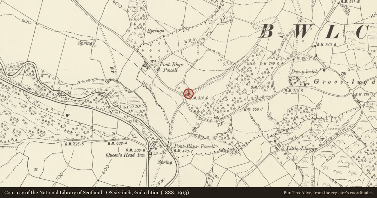
Slide toward Today to fade the historical sheet and see the modern map underneath.
David Rumsey Map Collection, Stanford LibrariesDavid Rumsey Map Collection, Stanford LibrariesDavid Rumsey Map Collection, Stanford LibrariesDavid Rumsey Map Collection, Stanford LibrariesDavid Rumsey Map Collection, Stanford Libraries
5 historical maps cover this location, the earliest the 1636 map "Cornubia : Devonia, Somersetus, Dorcestria, Wiltonia, Glocestria ..." (David Rumsey Map Collection, Stanford Libraries).
Historical maps covering this location
- 1636 · Cornubia : Devonia, Somersetus, Dorcestria, Wiltonia, Glocestria ... (David Rumsey Map Collection, Stanford Libraries)
- 1830 · V.3:11-15:XV.Britisches Reich. A. Kon: England. a. England ab sich: Shire:15-17, 33 (David Rumsey Map Collection, Stanford Libraries)
- 1895 · Sheet 11. Ordnance Survey of England and Wales. (David Rumsey Map Collection, Stanford Libraries)
- 1896 · 214 Talgarth (Hills) (David Rumsey Map Collection, Stanford Libraries)
- 1901 · Sheet 14. (David Rumsey Map Collection, Stanford Libraries)
Cadw's description
Location
Standing about 150m east of Pont Rhys Powell Farmhouse on the Cwmyoy road and about 300m north east of the Queen's Head Inn.
History
A small early C18 barn probably closely contemporary with the large barn dated 1703 at the nearby Pont Rhys Powell Farm.
Exterior
Pink/grey sandstone rubble with a Welsh slate roof. Small three bay barn with later attached cowhouse with lean-to corrugated asbestos sheet roof. Central opposed doors to the threshing floor. Small slit vent on either side and in each gable end. An unaltered small field barn.
Interior
Paved threshing floor. Two principal rafter trusses with raking struts, three tiers of trenched purlins and ridge piece. All the timbers including the surviving secondary rafters are original.
Reason for designation
Included as an unaltered example of a small early C18 barn having group value with the Farmhouse, Granary and Large Barn at Pont Rhys Powell Farm.
Nearby in the register
- Large Barn at Pont Rhys Powell FarmAgriculture and Subsistenceunder 1 mi
- Pont Rhys Powell FarmhouseDomesticunder 1 mi
- Granary and Stable at Pont Rhys Powell FarmAgriculture and Subsistenceunder 1 mi
- Pont Rhys Powell BridgeTransportunder 1 mi
Other entries of the same register within about three miles of this one, by straight line.