Cof Cymru: National Historic Assets of Wales · Wales
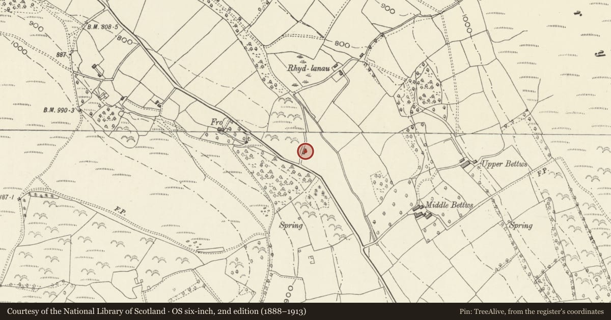
Barn at NGR 32936 22001
Crucorney, Monmouthshire, Wales
A Grade II listed building in Bettws, Abergavenny, Crucorney, Monmouthshire, designated on 29 January 1998.
The record
- Designation
- Listed building, Grade II
- Broad class
- Agriculture and Subsistence
- Date of designation
- 29 January 1998
- Locality
- Bettws
- Town
- Abergavenny
- Community
- Crucorney
- Unitary authority
- Monmouthshire
- Country
- Wales
- Coordinates
- 51.87415, -3.02736
- Cadw reference
- 19283
Slide toward Today to fade the historical sheet and see the modern map underneath.
David Rumsey Map Collection, Stanford LibrariesDavid Rumsey Map Collection, Stanford LibrariesDavid Rumsey Map Collection, Stanford LibrariesDavid Rumsey Map Collection, Stanford LibrariesDavid Rumsey Map Collection, Stanford Libraries
5 historical maps cover this location, the earliest the 1636 map "Cornubia : Devonia, Somersetus, Dorcestria, Wiltonia, Glocestria ..." (David Rumsey Map Collection, Stanford Libraries).
Historical maps covering this location
- 1636 · Cornubia : Devonia, Somersetus, Dorcestria, Wiltonia, Glocestria ... (David Rumsey Map Collection, Stanford Libraries)
- 1856 · 42. Brecon. (David Rumsey Map Collection, Stanford Libraries)
- 1895 · Sheet 11. Ordnance Survey of England and Wales. (David Rumsey Map Collection, Stanford Libraries)
- 1898 · 232 Abergavenny (Hills) (David Rumsey Map Collection, Stanford Libraries)
- 1901 · Sheet 14. (David Rumsey Map Collection, Stanford Libraries)
Cadw's description
Location
Up the track leading to Upper Bettws Farm off the road between Bettws and Forest Coal Pit.
History
A roadside barn dated 1831 and inscribed with name of the builder.
Exterior
Squared grey sandstone rubble with carefully cut quoins, metal sheeting roof of low pitch showing that it was originally Welsh slate. Barn lengthways to road with central timber cart doors, the flanking walls have two tiers of slit vents. The left gable has a taking-in door to the hayloft with slit vents below showing that there was a tallet within. The right hand gable has two tiers of slit vents. In the apex of this gable is an inscribed stone 'This building erected by John Morgan Esq. MDCCCXXXI'. The rear elevation was not seen at resurvey (May 1997).
Interior
Interior not available at the time of resurvey (May 1997).
Reason for designation
Included as a rare example of a dated early/mid C19 barn.
Nearby in the register
- Salem Presbyterian Chapel, with attached stableReligious, Ritual and Funeraryunder 1 mi
- Bettws ChapelReligious, Ritual and Funeraryunder 1 mi
- Pwll-y-hwyaid Farmhouse.Agriculture and Subsistenceunder 1 mi
- Pontyspig FarmhouseDomesticunder 1 mi
Other entries of the same register within about three miles of this one, by straight line.