Cof Cymru: National Historic Assets of Wales · Wales
Barn at Pen-y-dre Farm
Crucorney, Monmouthshire, Wales
A Grade II listed building in Llanvihangel Crucorney, Abergavenny, Crucorney, Monmouthshire, designated on 29 January 1998.
The record
- Designation
- Listed building, Grade II
- Broad class
- Agriculture and Subsistence
- Date of designation
- 29 January 1998
- Locality
- Llanvihangel Crucorney
- Town
- Abergavenny
- Community
- Crucorney
- Unitary authority
- Monmouthshire
- Country
- Wales
- Coordinates
- 51.87782, -2.98331
- Cadw reference
- 19282
Slide toward Today to fade the historical sheet and see the modern map underneath.
David Rumsey Map Collection, Stanford LibrariesDavid Rumsey Map Collection, Stanford LibrariesDavid Rumsey Map Collection, Stanford LibrariesDavid Rumsey Map Collection, Stanford LibrariesDavid Rumsey Map Collection, Stanford Libraries
5 historical maps cover this location, the earliest the 1608 map "(13) Cambriae Typus." (David Rumsey Map Collection, Stanford Libraries).
Historical maps covering this location
- 1608 · (13) Cambriae Typus. (David Rumsey Map Collection, Stanford Libraries)
- 1636 · Cornubia : Devonia, Somersetus, Dorcestria, Wiltonia, Glocestria ... (David Rumsey Map Collection, Stanford Libraries)
- 1830 · V.3:11-15:XV.Britisches Reich. A. Kon: England. a. England ab sich: Shire:15-17, 33 (David Rumsey Map Collection, Stanford Libraries)
- 1895 · Sheet 11. Ordnance Survey of England and Wales. (David Rumsey Map Collection, Stanford Libraries)
- 1901 · Sheet 14. (David Rumsey Map Collection, Stanford Libraries)
Cadw's description
Location
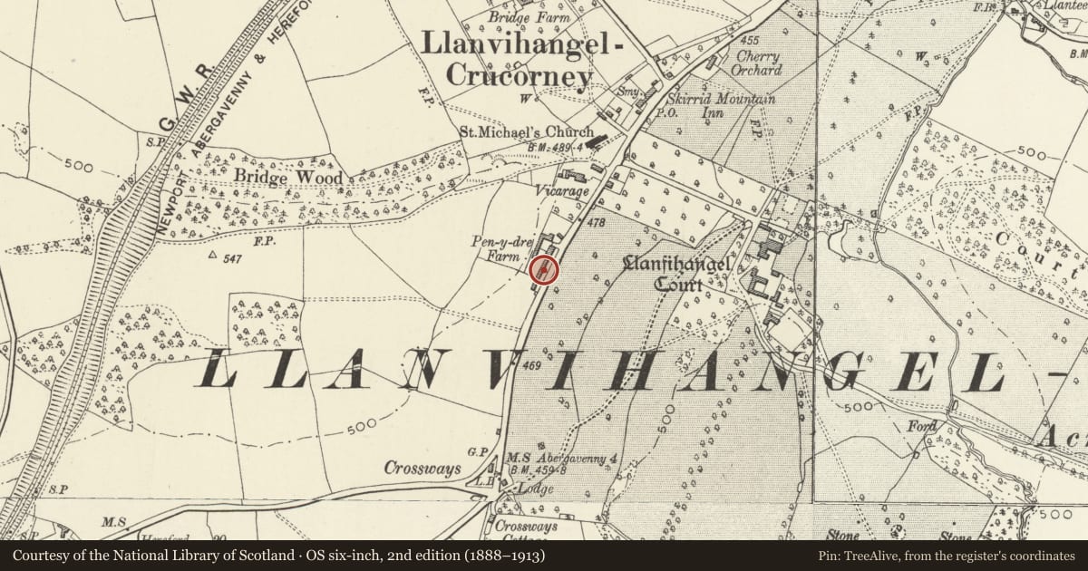
In Llanvihangel Crucorney village about 100m south east of the church of St Michael.
History
A C17 century corn barn with high quality timber framing in very good condition.
Exterior
Coursed red sandstone rubble with Welsh slate roof. The south gable is all stone, the other three walls are stone to a height of about 2m and then with two tiers of timber framed panels which are hidden by close boarding. This and the slate roof are probably late C19/earlyC20 changes. Central opposed doors. The stone gable has two tiers of slit vents and an owl hole at the gable apex.
Interior
Five bay barn with Queen strut trusses. Heavy timber framing with chamfered main posts bracketted to the wall plate and the tie beam. Three tiers of trenched purlins and ridge piece, all these are original. An unusual feature is the diagonal framing in the apex of the north gable.
Reason for designation
Included as a good example of a C17 corn barn in a prominent roadside position at the entrance to the village.
Nearby in the register
- Tomb of Daniel Gilbert in St Michael's ChurchyardReligious, Ritual and Funeraryunder 1 mi
- Tomb of Thomas Prosser in St Michael's ChurchyardReligious, Ritual and Funeraryunder 1 mi
- Church of St MichaelReligious, Ritual and Funeraryunder 1 mi
- Crossways CottageDomesticunder 1 mi
Other entries of the same register within about three miles of this one, by straight line.