Cof Cymru: National Historic Assets of Wales · Wales
Stable, cowhouse and implement shed at Pen-isha-plwydd Farm
Crucorney, Monmouthshire, Wales
A Grade II listed building in Pandy, Abergavenny, Crucorney, Monmouthshire, designated on 29 January 1998.
The record
- Designation
- Listed building, Grade II
- Broad class
- Agriculture and Subsistence
- Date of designation
- 29 January 1998
- Locality
- Pandy
- Town
- Abergavenny
- Community
- Crucorney
- Unitary authority
- Monmouthshire
- Country
- Wales
- Coordinates
- 51.90179, -2.95304
- Cadw reference
- 19274
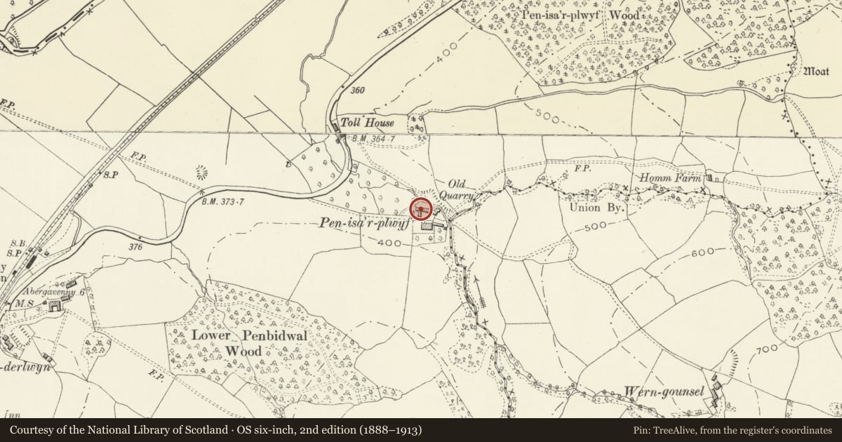
Slide toward Today to fade the historical sheet and see the modern map underneath.
David Rumsey Map Collection, Stanford LibrariesDavid Rumsey Map Collection, Stanford LibrariesDavid Rumsey Map Collection, Stanford LibrariesDavid Rumsey Map Collection, Stanford LibrariesDavid Rumsey Map Collection, Stanford Libraries
5 historical maps cover this location, the earliest the 1636 map "Cornubia : Devonia, Somersetus, Dorcestria, Wiltonia, Glocestria ..." (David Rumsey Map Collection, Stanford Libraries).
Historical maps covering this location
- 1636 · Cornubia : Devonia, Somersetus, Dorcestria, Wiltonia, Glocestria ... (David Rumsey Map Collection, Stanford Libraries)
- 1830 · V.3:11-15:XV.Britisches Reich. A. Kon: England. a. England ab sich: Shire:15-17, 33 (David Rumsey Map Collection, Stanford Libraries)
- 1895 · Sheet 11. Ordnance Survey of England and Wales. (David Rumsey Map Collection, Stanford Libraries)
- 1896 · 214 Talgarth (Hills) (David Rumsey Map Collection, Stanford Libraries)
- 1901 · Sheet 14. (David Rumsey Map Collection, Stanford Libraries)
Cadw's description
Location
In the north east corner of the Community about 1km from Pandy and approached by a lane off the Hereford road. The building faces the Farmhouse across the yard.
History
Pen-isha-plwydd Farm is a late C17 one which was upgraded in the C19. The farmhouse was greatly extended in c1870 and these buildings may date from then.
Exterior
Coursed red sandstone rubble with Welsh slate roofs. The building is in three parts in an L-shape facing the farmyard. From the left :- Implement shed with timber front and double doors. Cow shed which has its front hidden by a lean-to shed. Both of these have plain stone rear walls. Stable, two storeys with a hay loft above and a stable and tack room below. Door and two plain wiindows, one 6 over 6 sash to the ground floor, taking-in door above. Plain rear wall.
Interior
Sawn principal rafter trusses in the roofs of the three buildings, otherwise no special features.
Reason for designation
Included for their group value with the barn and farmhouse.
Nearby in the register
- Barn at Pen-isha-plwydd FarmAgriculture and Subsistenceunder 1 mi
- Pen-isha-plwydd FarmhouseDomesticunder 1 mi
- Goytre Wood Castle MoundMotteunder 1 mi
- Penbidwal Moated SiteMoated Siteunder 1 mi
Other entries of the same register within about three miles of this one, by straight line.