Cof Cymru: National Historic Assets of Wales · Wales
Tomb of Daniel (Chandler?) at Church of St Martin
Crucorney, Monmouthshire, Wales
A Grade II listed building in Cwmyoy, Abergavenny, Crucorney, Monmouthshire, designated on 29 January 1998.
The record
- Designation
- Listed building, Grade II
- Broad class
- Religious, Ritual and Funerary
- Date of designation
- 29 January 1998
- Locality
- Cwmyoy
- Town
- Abergavenny
- Community
- Crucorney
- Unitary authority
- Monmouthshire
- Country
- Wales
- Coordinates
- 51.90425, -3.01981
- Cadw reference
- 19266
Slide toward Today to fade the historical sheet and see the modern map underneath.
David Rumsey Map Collection, Stanford LibrariesDavid Rumsey Map Collection, Stanford LibrariesDavid Rumsey Map Collection, Stanford LibrariesDavid Rumsey Map Collection, Stanford LibrariesDavid Rumsey Map Collection, Stanford Libraries
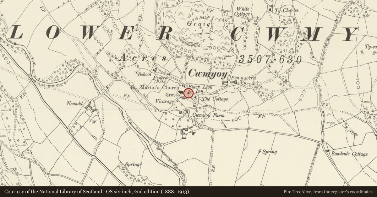
5 historical maps cover this location, the earliest the 1636 map "Cornubia : Devonia, Somersetus, Dorcestria, Wiltonia, Glocestria ..." (David Rumsey Map Collection, Stanford Libraries).
Historical maps covering this location
- 1636 · Cornubia : Devonia, Somersetus, Dorcestria, Wiltonia, Glocestria ... (David Rumsey Map Collection, Stanford Libraries)
- 1856 · 42. Brecon. (David Rumsey Map Collection, Stanford Libraries)
- 1895 · Sheet 11. Ordnance Survey of England and Wales. (David Rumsey Map Collection, Stanford Libraries)
- 1896 · 214 Talgarth (Hills) (David Rumsey Map Collection, Stanford Libraries)
- 1901 · Sheet 14. (David Rumsey Map Collection, Stanford Libraries)
Cadw's description
Location
About 20 m east of the chancel of the Church of St Martin.
History
The earliest inscription is to Daniel...., the surname is illegible, who died in 1812. The style suggests that it was erected at that time.
Exterior
Limestone chest tomb. Rectangular with framed panels on each face. Horizontal tooling suggests corner pilasters. Roll moulding at top and flat slab with rolled edge. The oldest inscription is damaged, to Daniel..., died in 1812. Secondary inscription to Hannah Chandler, also died 1812.
Reason for designation
Included as a good example of a neo-classical chest tomb. It has group value with the church and churchyard cross, and is the best example there.
Nearby in the register
- Cross in St Martin's ChurchyardReligious, Ritual and Funeraryunder 1 mi
- Cwmyoy Churchyard CrossCrossunder 1 mi
- Church of St MartinReligious, Ritual and Funeraryunder 1 mi
- Ty CharlesDomesticunder 1 mi
Other entries of the same register within about three miles of this one, by straight line.