Cof Cymru: National Historic Assets of Wales · Wales
Brick Barn at Ty Coch
Trefnant, Denbighshire, Wales
A Grade II listed building in Ty Coch, Denbigh, Trefnant, Denbighshire, designated on 9 January 1998.
The record
- Designation
- Listed building, Grade II
- Broad class
- Agriculture and Subsistence
- Date of designation
- 9 January 1998
- Locality
- Ty Coch
- Town
- Denbigh
- Community
- Trefnant
- Unitary authority
- Denbighshire
- Country
- Wales
- Coordinates
- 53.22436, -3.39031
- Cadw reference
- 19217
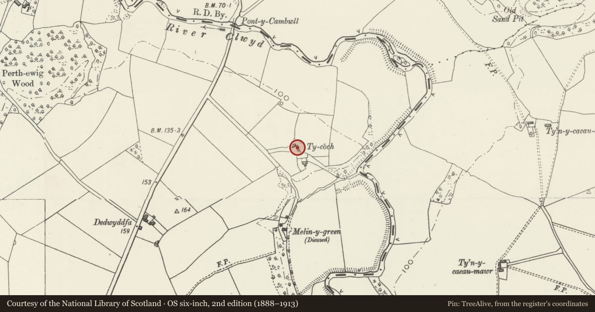
Slide toward Today to fade the historical sheet and see the modern map underneath.
David Rumsey Map Collection, Stanford LibrariesDavid Rumsey Map Collection, Stanford LibrariesLlyfrgell Genedlaethol Cymru – The National Library of WalesDavid Rumsey Map Collection, Stanford LibrariesDavid Rumsey Map Collection, Stanford Libraries
5 historical maps cover this location, the earliest the 1608 map "(13) Cambriae Typus." (David Rumsey Map Collection, Stanford Libraries).
Historical maps covering this location
- 1608 · (13) Cambriae Typus. (David Rumsey Map Collection, Stanford Libraries)
- 1795 · To Sir Watkin Williams-Wynn Bart ... the map of the six counties of North Wales is most… (Llyfrgell Genedlaethol Cymru – The National Library of Wales)
- 1830 · V.3:11-15:XV. Britisches Reich. A. Kon: England. b. Frstenthum Wales: Shire: 37-40 (David Rumsey Map Collection, Stanford Libraries)
- 1883 · Watershed map England, Wales 3. (David Rumsey Map Collection, Stanford Libraries)
- 1901 · Sheet 9 and 10. (David Rumsey Map Collection, Stanford Libraries)
Cadw's description
Location
Located at the end of the drive to Ty Coch, some 50m NW of the house and adjacent to the primary barn.
History
Late C17 brick barn built c1683 to serve nearby Ty Coch, completed in that year. The barn was re-roofed during a restoration of 1899-1901.
Exterior
Two-storey random-bond brick barn with slate roof and tiled ridge; coped and kneelered gable parapets with sandstone slabs and original shaped kneelers. Opposing entrances, that to the front modern and in an enlarged opening, both with boarded double doors. Two tiers of ventilation slits to sides (mostly blocked) with 4 tiers visible to the L gable (W). Twelve-pane 2-part casement to upper floor on N side, with boarded window/loading bay to L; ladder access. Two paired leaded windows to E gable with a leaded cross-window to first floor (all c1900). This has a sandstone lintel and a segmental brick relieving arch.
Interior
C19 king-post roof; modern garage to ground floor.
Reason for designation
Listed as a late C17 brick barn and for its group value with the adjoining former agricultural range at Ty Coch.
Nearby in the register
- Former Agricultural Range at Ty CochAgriculture and Subsistenceunder 1 mi
- Ty CochDomesticunder 1 mi
- Pont-y-Cambwll (partly in Tremeirchion Community)Transportunder 1 mi
- Pont-y-cambwllTransportunder 1 mi
Other entries of the same register within about three miles of this one, by straight line.