Cof Cymru: National Historic Assets of Wales · Wales
Walton West Farmhouse
The Havens, Pembrokeshire, Wales
A Grade II listed building in Walton West, Haverfordwest, The Havens, Pembrokeshire, designated on 26 November 1997.
The record
- Designation
- Listed building, Grade II
- Broad class
- Domestic
- Date of designation
- 26 November 1997
- Locality
- Walton West
- Town
- Haverfordwest
- Community
- The Havens
- Unitary authority
- Pembrokeshire
- Country
- Wales
- Coordinates
- 51.77460, -5.09900
- Cadw reference
- 19102
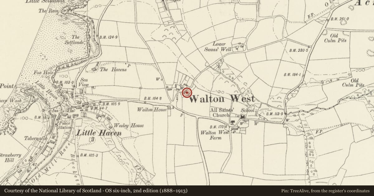
Slide toward Today to fade the historical sheet and see the modern map underneath.
David Rumsey Map Collection, Stanford LibrariesDavid Rumsey Map Collection, Stanford LibrariesDavid Rumsey Map Collection, Stanford LibrariesDavid Rumsey Map Collection, Stanford LibrariesDavid Rumsey Map Collection, Stanford Libraries
5 historical maps cover this location, the earliest the 1608 map "(13) Cambriae Typus." (David Rumsey Map Collection, Stanford Libraries).
Historical maps covering this location
- 1608 · (13) Cambriae Typus. (David Rumsey Map Collection, Stanford Libraries)
- 1636 · Cornubia : Devonia, Somersetus, Dorcestria, Wiltonia, Glocestria ... (David Rumsey Map Collection, Stanford Libraries)
- 1898 · 227 Milford (Hills) (David Rumsey Map Collection, Stanford Libraries)
- 1898 · 227 Milford (Outline) (David Rumsey Map Collection, Stanford Libraries)
- 1901 · Sheet 13. (David Rumsey Map Collection, Stanford Libraries)
Cadw's description
Location
Situated some 60m NE of the cross roads in Walton West, on the NW side of the road running to Broadway.
History
Farmhouse, probably early C19, marked on the Walton West Tithe Map of 1841 as a holding of 61 acres (24.7 hectares), owned and occupied by William Rees, who owned a total of 102 acres (43 hectares) in the parish at that time.
Exterior
Farmhouse, colourwashed rubble stone with grouted slate roof and stone end stacks. Stacks have stone weathercoursing and cornices, and larger, kitchen, stack is to right. Two-storey, three-window front, offset to left. Horned sashes with marginal glazing bars, the upper sashes under eaves and with floor-level painted stone sills. Ground floor centre 4-panel door and larger sash each side, all with tooled stone voussoirs and keystones. Painted stone sills. Added service wing to right with grouted slate roof, single-storey, with C20 door and matching sash, both with matching voussoirs and keystones.
Reason for designation
A smaller traditional farmhouse with the offset facade and low upper storey typical of the late C18 and early C19.
Nearby in the register
- Church of All SaintsReligious, Ritual and Funeraryunder 1 mi
- Haven Fort HotelCommercialunder 1 mi
- Manor HouseDomesticunder 1 mi
- Broad Haven HouseDomesticunder 1 mi
Other entries of the same register within about three miles of this one, by straight line.