Cof Cymru: National Historic Assets of Wales · Wales
Outbuilding on S side of yard at Dan-y-graig
Meidrim, Carmarthenshire, Wales
A Grade II listed building in Drefach, Carmarthen, Meidrim, Carmarthenshire, designated on 25 November 1997.
The record
- Designation
- Listed building, Grade II
- Broad class
- Agriculture and Subsistence
- Date of designation
- 25 November 1997
- Locality
- Drefach
- Town
- Carmarthen
- Community
- Meidrim
- Unitary authority
- Carmarthenshire
- Country
- Wales
- Coordinates
- 51.86721, -4.47292
- Cadw reference
- 19093
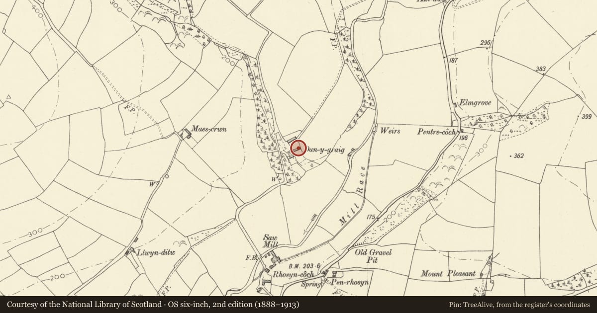
Slide toward Today to fade the historical sheet and see the modern map underneath.
David Rumsey Map Collection, Stanford LibrariesDavid Rumsey Map Collection, Stanford LibrariesDavid Rumsey Map Collection, Stanford LibrariesDavid Rumsey Map Collection, Stanford LibrariesDavid Rumsey Map Collection, Stanford Libraries
5 historical maps cover this location, the earliest the 1636 map "Cornubia : Devonia, Somersetus, Dorcestria, Wiltonia, Glocestria ..." (David Rumsey Map Collection, Stanford Libraries).
Historical maps covering this location
- 1636 · Cornubia : Devonia, Somersetus, Dorcestria, Wiltonia, Glocestria ... (David Rumsey Map Collection, Stanford Libraries)
- 1830 · V.3:11-15:XV. Britisches Reich. A. Kon: England. b. Frstenthum Wales: Shire: 37-40 (David Rumsey Map Collection, Stanford Libraries)
- 1860 · 41. Caermathen. (David Rumsey Map Collection, Stanford Libraries)
- 1891 · Sheet 10. Ordnance Survey of England and Wales. . (David Rumsey Map Collection, Stanford Libraries)
- 1901 · Sheet 14. (David Rumsey Map Collection, Stanford Libraries)
Cadw's description
Location
Set in the slope of the farmyard to north of Dan-y-graig which is situated approximately 1km north of B4298 at Drefach near Meidrim.
History
Outbuilding, earlier to mid C19, former cow-house and loose-box or stable.
Exterior
Outbuilding, whitewashed rubble stone with asbestos sheet roof, except over right end loose-box or stable, which retains slates. Brick heads to openings. Cow-house has 2 doors in deep reveals, blocked centre door now 8-pane window, and 6-pane window next to right door, probably also in former door. Right end has single door between 2 windows with slate sills. Right end wall has window.
Evidence in rear wall that roof has been raised.
Interior
Cow-house has rear feed-passage and 11 collar trusses. Three windows in rear wall. Dividing wall to right end section, which has 3 trusses.
Reason for designation
Included for group value with Dan-y-graig and associated farm buildings as part of a well-preserved C19 farm group.
Nearby in the register
- Dan-y-GraigDomesticunder 1 mi
- Outbuilding on N side of yard at Dan-y-graigAgriculture and Subsistenceunder 1 mi
- Outside toilet at Dan-y-graigDomesticunder 1 mi
- Smithy at DanyrhiwIndustrialunder 1 mi
Other entries of the same register within about three miles of this one, by straight line.