Cof Cymru: National Historic Assets of Wales · Wales
No 2 The Cross
Tirymynach, Ceredigion, Wales
A Grade II listed building in Clarach, Aberystwyth, Tirymynach, Ceredigion, designated on 12 November 1997.
The record
- Designation
- Listed building, Grade II
- Broad class
- Domestic
- Date of designation
- 12 November 1997
- Locality
- Clarach
- Town
- Aberystwyth
- Community
- Tirymynach
- Unitary authority
- Ceredigion
- Country
- Wales
- Coordinates
- 52.43574, -4.05804
- Cadw reference
- 19063
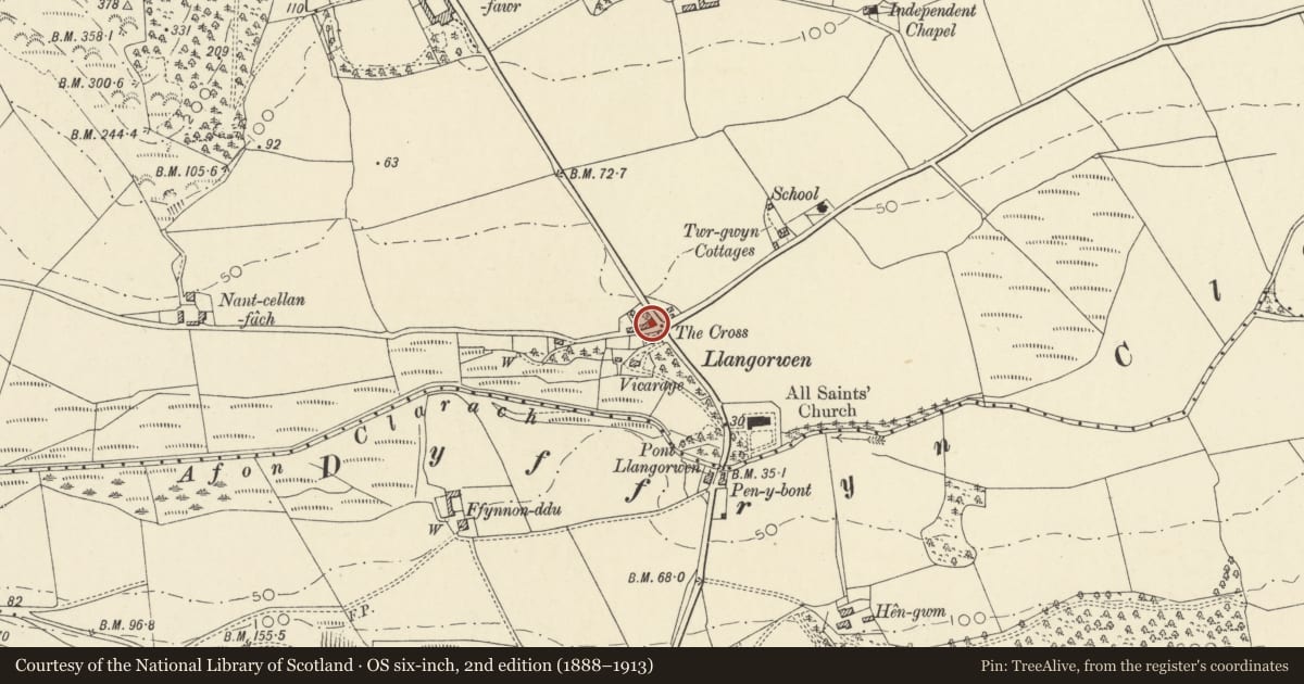
Slide toward Today to fade the historical sheet and see the modern map underneath.
David Rumsey Map Collection, Stanford LibrariesDavid Rumsey Map Collection, Stanford LibrariesDavid Rumsey Map Collection, Stanford LibrariesDavid Rumsey Map Collection, Stanford LibrariesDavid Rumsey Map Collection, Stanford Libraries
5 historical maps cover this location, the earliest the 1830 map "V.3:11-15:XV. Britisches Reich. A. Kon: England. b. Frstenthum Wales: Shire: 37-40" (David Rumsey Map Collection, Stanford Libraries).
Historical maps covering this location
- 1830 · V.3:11-15:XV. Britisches Reich. A. Kon: England. b. Frstenthum Wales: Shire: 37-40 (David Rumsey Map Collection, Stanford Libraries)
- 1883 · Watershed map England, Wales 3. (David Rumsey Map Collection, Stanford Libraries)
- 1896 · Sheet 7. Ordnance Survey of England and Wales. (David Rumsey Map Collection, Stanford Libraries)
- 1899 · 163 Aberystwyth (Hills) (David Rumsey Map Collection, Stanford Libraries)
- 1901 · Sheet 14. (David Rumsey Map Collection, Stanford Libraries)
Cadw's description
Location
Eastern house of a row of three cottages on NW side of crossroads in Clarach, on intersection.
History
Earlier C19 cottage, once part of the Cwmcynfelin estate, part of a row of three lofted cottages, but substantially larger than Nos 3 or 4. Old photographs show No 1, demolished for road-widening, adjoined to E. The row is shown on the Tithe map of 1847, but not on the earlier O.S. map 1823.
Exterior
One and a half storey croglofft cottage, two-unit plan. Painted rough-cast walls, said to be earth built. Roof is gabled with small slates, and 2 rough-cast small end chimneys. S front has boarded door in centre, with a small 2-light casement window on each side. 2 small gabled eaves dormer windows above, with C20 casements. E end has front wall set-back for side of chimney, and then truncated remains of chimney of the demolished No 1 abuts to E.
Reason for designation
An earlier C19 vernacular cottage, retaining early character in plan, scale and disposition of features, and forming part of a group with the cottage pair to left, Nos 3 and 4.
Nearby in the register
- No 3 The CrossDomesticunder 1 mi
- Crow's Nest, No 4 The CrossDomesticunder 1 mi
- Church of All SaintsReligious, Ritual and Funeraryunder 1 mi
- Pont LlangorwenTransportunder 1 mi
Other entries of the same register within about three miles of this one, by straight line.