Cof Cymru: National Historic Assets of Wales · Wales
Zoar Chapel
Coychurch Higher, Bridgend, Wales
A Grade II listed building in Rhiwceiliog, Coychurch Higher, Bridgend, designated on 13 November 1997.
The record
- Designation
- Listed building, Grade II
- Broad class
- Religious, Ritual and Funerary
- Date of designation
- 13 November 1997
- Locality
- Rhiwceiliog
- Community
- Coychurch Higher
- Unitary authority
- Bridgend
- Country
- Wales
- Coordinates
- 51.54849, -3.48327
- Cadw reference
- 19047
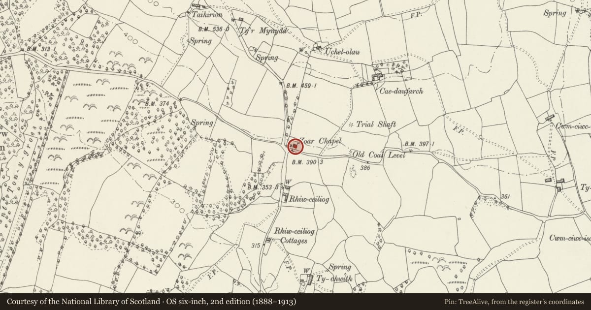
Slide toward Today to fade the historical sheet and see the modern map underneath.
David Rumsey Map Collection, Stanford LibrariesDavid Rumsey Map Collection, Stanford LibrariesDavid Rumsey Map Collection, Stanford LibrariesDavid Rumsey Map Collection, Stanford LibrariesDavid Rumsey Map Collection, Stanford Libraries
5 historical maps cover this location, the earliest the 1636 map "Cornubia : Devonia, Somersetus, Dorcestria, Wiltonia, Glocestria ..." (David Rumsey Map Collection, Stanford Libraries).
Historical maps covering this location
- 1636 · Cornubia : Devonia, Somersetus, Dorcestria, Wiltonia, Glocestria ... (David Rumsey Map Collection, Stanford Libraries)
- 1637 · The fourth table of England. Cornub. Devonia, Somerset etc. (David Rumsey Map Collection, Stanford Libraries)
- 1865 · England and Wales. England No. 6. (David Rumsey Map Collection, Stanford Libraries)
- 1895 · Sheet 11. Ordnance Survey of England and Wales. (David Rumsey Map Collection, Stanford Libraries)
- 1907 · 248 Pontypridd (Hills) (David Rumsey Map Collection, Stanford Libraries)
Cadw's description
Location
Situated in a prominent position where two lanes cross. To the N the land rises up steeply to the Mynydd y Gaer. The chapel and its vestry are fronted by a low wall with iron railings. Two piers with truncated pyramidal copings flank the entrance.
History
Calvinistic Methodist chapel built in 1876, replacing an earlier chapel of 1851. Daughter chapel of Salem, Pencoed, both were designed by Rev. William Jones of Pentre Ystrad and built by Edmund Rees, the cost of Soar being £600.
Exterior
Simple classical style with 3-bay gable-end facade. Rendered and pebble dashed under a slate roof with wooden boarded eaves and verges. Concrete rendered plinth and dressings. The facade has wood planked double doors under an arched head with fan light. It is flanked by tall multi-pane windows with round heads and stone sills. There is a similar but shorter window above the doorway. In the gable is a circular vent with a tablet below stating:
SOAR / TREFNYDDION CALVINAIDD / 1876.
The rear is plain except for a vent in the gable. The side walls are 2-window, the windows having arched heads and stone sills but without dressings. Each window has a 4-pane sash at the base with multi-pane glazing above including radial glazing beneath the arch. Though the sashes are later, the glazing above is original. There is a wide pilaster between the windows on the E side.
Interior
The interior contains a 3-sided gallery supported on simple cast iron columns. The gallery front is of polished wood with moulded recessed panels. Between each panel is a white painted pilaster with console. There are 3 rows of panelled pews in the gallery. The ceiling has a moulded cornice and a fine decorated ceiling rose in the centre, with 4 rosettes in the corners. At ground floor level are 6 rows of box-style pews with carved raked ends. There is a vestibule to the rear with access to the ground floor and gallery. The simple set fawr is C20. Behind it is a blind arch with plain pilasters, fluted consoles and moulded round arch.
Reason for designation
Listed as a well-proportioned rural chapel associated with early industrial development in the area, and retaining its original character.
Nearby in the register
- Zoar Chapel VestryReligious, Ritual and Funeraryunder 1 mi
- Mynydd y GaerHillfortunder 1 mi
- Wern Tarw and attached CowhouseAgriculture and Subsistenceunder 1 mi
- Barn at Wern TarwAgriculture and Subsistenceunder 1 mi
Other entries of the same register within about three miles of this one, by straight line.