Cof Cymru: National Historic Assets of Wales · Wales
Lady Eleanor's Tower
Llanddulas and Rhyd-y-Foel, Conwy, Wales
A Grade II listed building in Gwrych Castle, Abergele, Llanddulas and Rhyd-y-Foel, Conwy, designated on 12 November 1997.
The record
- Designation
- Listed building, Grade II
- Broad class
- Gardens, Parks and Urban Spaces
- Date of designation
- 12 November 1997
- Locality
- Gwrych Castle
- Town
- Abergele
- Community
- Llanddulas and Rhyd-y-Foel
- Unitary authority
- Conwy
- Country
- Wales
- Coordinates
- 53.28458, -3.62351
- Cadw reference
- 19036
Slide toward Today to fade the historical sheet and see the modern map underneath.
David Rumsey Map Collection, Stanford LibrariesDavid Rumsey Map Collection, Stanford LibrariesDavid Rumsey Map Collection, Stanford LibrariesLlyfrgell Genedlaethol Cymru – The National Library of WalesDavid Rumsey Map Collection, Stanford Libraries
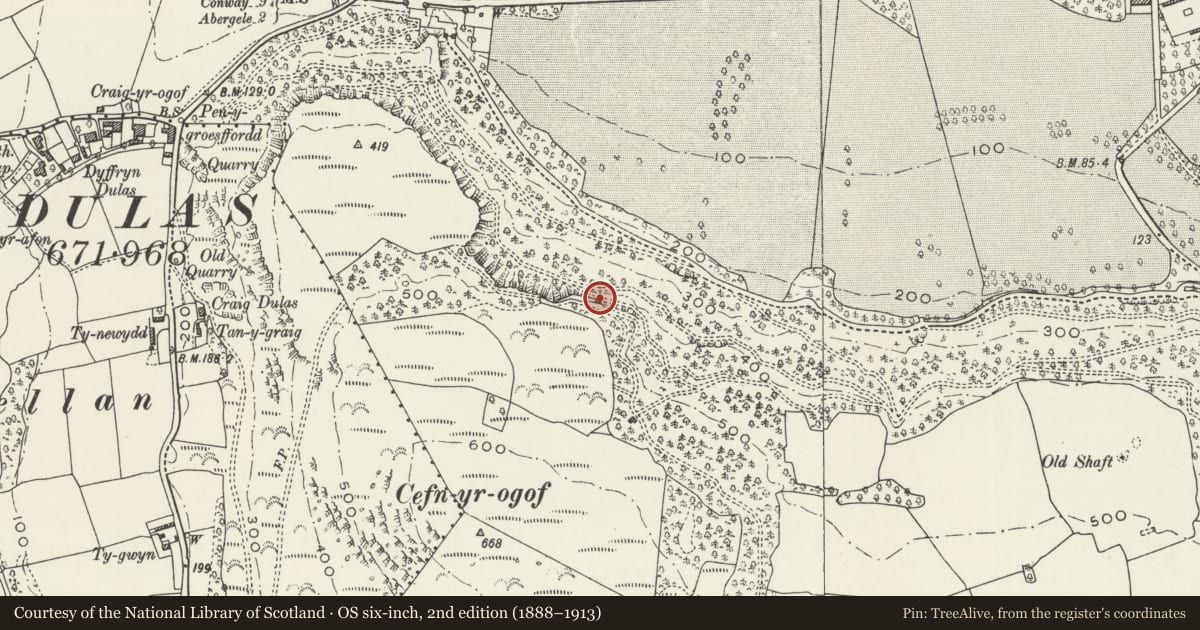
5 historical maps cover this location, the earliest the 1795 map "To Sir Watkin Williams-Wynn Bart ... the map of the six counties of North Wales is most humbly inscribed by his obedient humble servant" (Llyfrgell Genedlaethol Cymru – The National Library of Wales).
Historical maps covering this location
- 1795 · To Sir Watkin Williams-Wynn Bart ... the map of the six counties of North Wales is most… (Llyfrgell Genedlaethol Cymru – The National Library of Wales)
- 1830 · V.3:11-15:XV. Britisches Reich. A. Kon: England. b. Frstenthum Wales: Shire: 37-40 (David Rumsey Map Collection, Stanford Libraries)
- 1883 · Watershed map England, Wales 3. (David Rumsey Map Collection, Stanford Libraries)
- 1898 · 95 Rhyl (Hills) (David Rumsey Map Collection, Stanford Libraries)
- 1901 · Sheet 9 and 10. (David Rumsey Map Collection, Stanford Libraries)
Cadw's description
Location
Strikingly located on a wooded crag, set back from and above the road; approximately 750m W of Gwrych Castle.
History
Early C20; constructed for Countess Dundonald of Gwrych Castle and one of the last of a number of folly towers, gates and similar erections built on the estate from c1819 until the beginning of the first war. Traditionally said to have been built by the grieving countess in 1915 to commemorate the loss of her son at sea.
Exterior
Square tower of two-and-a-half stages; of local limestone rubble on rock foundations. Segmentally-headed window openings to N E and W with access to the S; large corner crenellations give fictive battlements.
Reason for designation
Included as a striking folly tower on the Gwrych estate, part of this nationally important Picturesque composition.
Nearby in the register
- Northern TowersDomesticunder 1 mi
- Tan-yr-Ogof Farmhouse including adjoining arch and walls to EDomesticunder 1 mi
- Tan-yr-Ogof Lodge including adjoining walls and towers to S, E and WDomesticunder 1 mi
- Stable and Cart House Range at Tan-yr-Ogof FarmAgriculture and Subsistenceunder 1 mi
Other entries of the same register within about three miles of this one, by straight line.