Cof Cymru: National Historic Assets of Wales · Wales
Ty Ucha Bach
Llanddulas and Rhyd-y-Foel, Conwy, Wales
A Grade II listed building in Llanddulas, Abergele, Llanddulas and Rhyd-y-Foel, Conwy, designated on 11 July 1988.
The record
- Designation
- Listed building, Grade II
- Broad class
- Domestic
- Date of designation
- 11 July 1988
- Locality
- Llanddulas
- Town
- Abergele
- Community
- Llanddulas and Rhyd-y-Foel
- Unitary authority
- Conwy
- Country
- Wales
- Coordinates
- 53.28865, -3.63905
- Cadw reference
- 19030
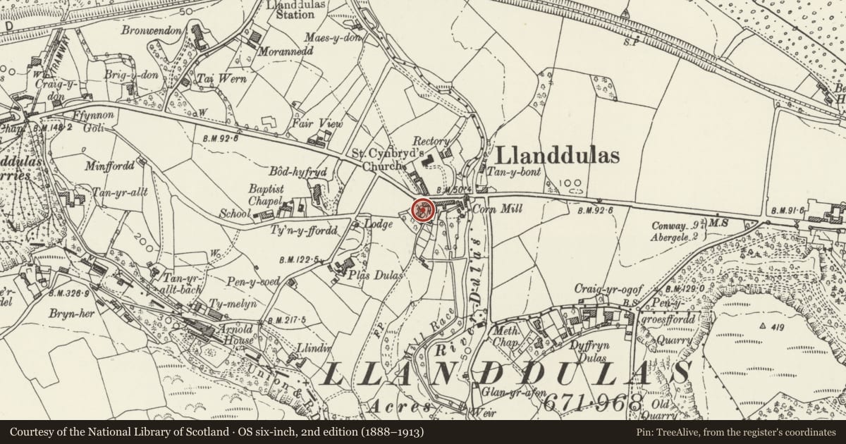
Slide toward Today to fade the historical sheet and see the modern map underneath.
David Rumsey Map Collection, Stanford LibrariesDavid Rumsey Map Collection, Stanford LibrariesDavid Rumsey Map Collection, Stanford LibrariesLlyfrgell Genedlaethol Cymru – The National Library of WalesDavid Rumsey Map Collection, Stanford Libraries
5 historical maps cover this location, the earliest the 1795 map "To Sir Watkin Williams-Wynn Bart ... the map of the six counties of North Wales is most humbly inscribed by his obedient humble servant" (Llyfrgell Genedlaethol Cymru – The National Library of Wales).
Historical maps covering this location
- 1795 · To Sir Watkin Williams-Wynn Bart ... the map of the six counties of North Wales is most… (Llyfrgell Genedlaethol Cymru – The National Library of Wales)
- 1830 · V.3:11-15:XV. Britisches Reich. A. Kon: England. b. Frstenthum Wales: Shire: 37-40 (David Rumsey Map Collection, Stanford Libraries)
- 1883 · Watershed map England, Wales 3. (David Rumsey Map Collection, Stanford Libraries)
- 1898 · 95 Rhyl (Hills) (David Rumsey Map Collection, Stanford Libraries)
- 1901 · Sheet 9 and 10. (David Rumsey Map Collection, Stanford Libraries)
Cadw's description
Location
Located in the village centre diagonally opposite St. Cynbryd's Church; set back from the main road with a forecourt to the NW.
History
Storeyed lobby-entry house, probably C17 to which a three storey, 3-bay range has been added at the upper (NW) end, possibly incorporating the end bay of the primary range. The addition, of the earlier C18 and re-orientated to the NW, became the new house, with the original section becoming a service wing. In the later C18 and C19 further service additions were added to the NE, NW and SE; these are all now separate units (May 1997).
Exterior
Low modern forecourt walls form an arc to the front (SE).
Interior
The interior was not inspected at the time of survey (5/97).
Reason for designation
Included for Group Value with other listed items at Ty Ucha.
Nearby in the register
- Ty UchaDomesticunder 1 mi
- Ty Ucha CottageDomesticunder 1 mi
- Ty UchaDomesticunder 1 mi
- Ty Ucha HouseDomesticunder 1 mi
Other entries of the same register within about three miles of this one, by straight line.