Cof Cymru: National Historic Assets of Wales · Wales
Derry Cottage
Lampeter Velfrey, Pembrokeshire, Wales
A Grade II listed building in Tygwyn, Lampeter Velfrey, Pembrokeshire, designated on 15 October 1997.
The record
- Designation
- Listed building, Grade II
- Broad class
- Domestic
- Date of designation
- 15 October 1997
- Locality
- Tygwyn
- Community
- Lampeter Velfrey
- Unitary authority
- Pembrokeshire
- Country
- Wales
- Coordinates
- 51.80068, -4.66075
- Cadw reference
- 18999
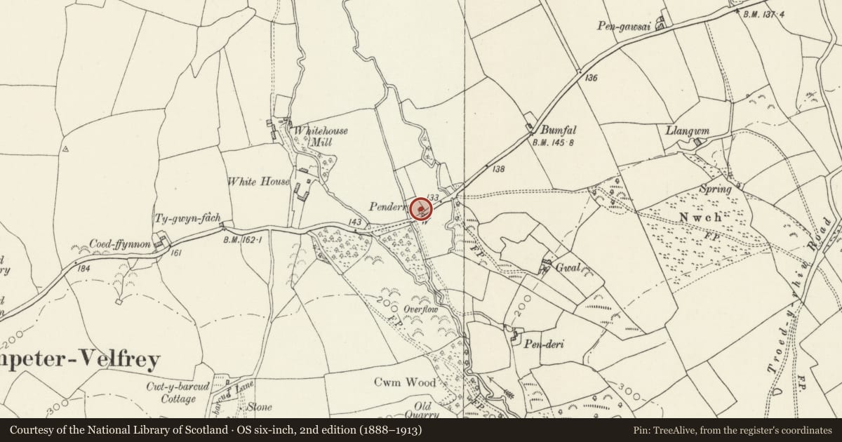
Slide toward Today to fade the historical sheet and see the modern map underneath.
David Rumsey Map Collection, Stanford LibrariesDavid Rumsey Map Collection, Stanford LibrariesDavid Rumsey Map Collection, Stanford LibrariesDavid Rumsey Map Collection, Stanford LibrariesDavid Rumsey Map Collection, Stanford Libraries
5 historical maps cover this location, the earliest the 1636 map "Cornubia : Devonia, Somersetus, Dorcestria, Wiltonia, Glocestria ..." (David Rumsey Map Collection, Stanford Libraries).
Historical maps covering this location
- 1636 · Cornubia : Devonia, Somersetus, Dorcestria, Wiltonia, Glocestria ... (David Rumsey Map Collection, Stanford Libraries)
- 1830 · V.3:11-15:XV. Britisches Reich. A. Kon: England. b. Frstenthum Wales: Shire: 37-40 (David Rumsey Map Collection, Stanford Libraries)
- 1891 · Sheet 10. Ordnance Survey of England and Wales. . (David Rumsey Map Collection, Stanford Libraries)
- 1898 · 228 Haverfordwest (Hills) (David Rumsey Map Collection, Stanford Libraries)
- 1901 · Sheet 13. (David Rumsey Map Collection, Stanford Libraries)
Cadw's description
Location
At N side of the road to Whitland near the crossing of the Avon Cwm, 1 km E of Lampeter Velfrey village. Small front garden with hedge, iron gate and cobbled path to door.
History
A vernacular cottage probably of the C18 with picturesque C19 alterations.
Exterior
Two unit cottage with loft, facing S to the road, its parlour to the W and its kitchen to the E. Rendered and colour-washed at front and ends. Large rendered end-chimney over the E gable, smaller rendered end-chimney over the W gable. Two hornless sash windows to front, each of twelve panes. Door centrally, six panelled with bolection mouldings. In the E gable is a small loft window towards the rear, four panes. In the W gable is a larger loft window of sash type towards the front, four panes, late 19C.
The cottage has been given an unusual front verandah with four timber posts. The posts are unequally spaced so that the two intermediate ones are close to the door; they have seats either side of the door framed into them. The posts carry an ornamental eaves of some depth, with a decorative eaves beam and a fascia of vertical boarding above. Ornamentally carved bargeboards. The roof covering is now of corrugated steel sheeting, in two lengths per slope, without guttering. It is not known if an earlier roof covering survives beneath. The covering, bargeboards, eaves and posts are all painted red.
C20 single-storey extension at E.
Reason for designation
Listed as a well-preserved vernacular cottage with picturesque additions.
Nearby in the register
- Carvan Congregational ChapelReligious, Ritual and Funeraryunder 1 mi
- Church of St. PeterReligious, Ritual and Funeraryunder 1 mi
- CastellRingworkunder 1 mi
- War MemorialReligious, Ritual and Funeraryunder 1 mi
Other entries of the same register within about three miles of this one, by straight line.