Cof Cymru: National Historic Assets of Wales · Wales
Mounton Quarry Limekiln
Templeton, Pembrokeshire, Wales
A Grade II listed building in Mounton, Templeton, Pembrokeshire, designated on 15 October 1997.
The record
- Designation
- Listed building, Grade II
- Broad class
- Industrial
- Date of designation
- 15 October 1997
- Locality
- Mounton
- Community
- Templeton
- Unitary authority
- Pembrokeshire
- Country
- Wales
- Coordinates
- 51.77519, -4.78188
- Cadw reference
- 18980
Slide toward Today to fade the historical sheet and see the modern map underneath.
David Rumsey Map Collection, Stanford LibrariesDavid Rumsey Map Collection, Stanford LibrariesDavid Rumsey Map Collection, Stanford LibrariesDavid Rumsey Map Collection, Stanford LibrariesDavid Rumsey Map Collection, Stanford Libraries
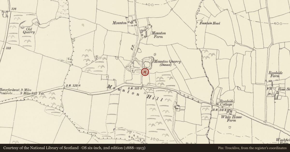
5 historical maps cover this location, the earliest the 1636 map "Cornubia : Devonia, Somersetus, Dorcestria, Wiltonia, Glocestria ..." (David Rumsey Map Collection, Stanford Libraries).
Historical maps covering this location
- 1636 · Cornubia : Devonia, Somersetus, Dorcestria, Wiltonia, Glocestria ... (David Rumsey Map Collection, Stanford Libraries)
- 1830 · V.3:11-15:XV. Britisches Reich. A. Kon: England. b. Frstenthum Wales: Shire: 37-40 (David Rumsey Map Collection, Stanford Libraries)
- 1891 · Sheet 10. Ordnance Survey of England and Wales. . (David Rumsey Map Collection, Stanford Libraries)
- 1898 · 228 Haverfordwest (Hills) (David Rumsey Map Collection, Stanford Libraries)
- 1901 · Sheet 13. (David Rumsey Map Collection, Stanford Libraries)
Cadw's description
Location
To the N side of the A4115, and to the E of the lane leading to Mounton Farm. A flooded quarry lies immediately to the N.
History
A limekiln probably of the early C19, and probably disused by the mid C19, as there appears to be no trace of any firebrick lining.
Exterior
Large irregular freestanding single limekiln with working apertures to NW and SE, built in the coarse local stone. The openings are corbelled over. It faces the farm lane at the W, and has a straight wall on that side. At the N there is some informal buttressing.
From the SW a ramp rises from the lane to the top. Near the top are some low walls, the remnant of a hut with its back to the lane.
Interior
The void is barrel-shaped, narrowing from about 2.5 m near the top to about 2 m at the bottom.
Reason for designation
Well preserved and unusually large freestanding limekiln, with remnant of a hut.
Nearby in the register
- Molleston CampEnclosureunder 1 mi
- Mounton ChapelReligious, Ritual and Funeraryunder 1 mi
- Molleston Baptist ChapelReligious, Ritual and Funeraryunder 1 mi
- Burnt Mound North of Dinaston FarmBurnt Moundunder 1 mi
Other entries of the same register within about three miles of this one, by straight line.