Cof Cymru: National Historic Assets of Wales · Wales
Elm House
Templeton, Pembrokeshire, Wales
A Grade II listed building in Templeton Village, Templeton, Pembrokeshire, designated on 15 October 1997.
The record
- Designation
- Listed building, Grade II
- Broad class
- Domestic
- Date of designation
- 15 October 1997
- Locality
- Templeton Village
- Community
- Templeton
- Unitary authority
- Pembrokeshire
- Country
- Wales
- Coordinates
- 51.77393, -4.73709
- Cadw reference
- 18976
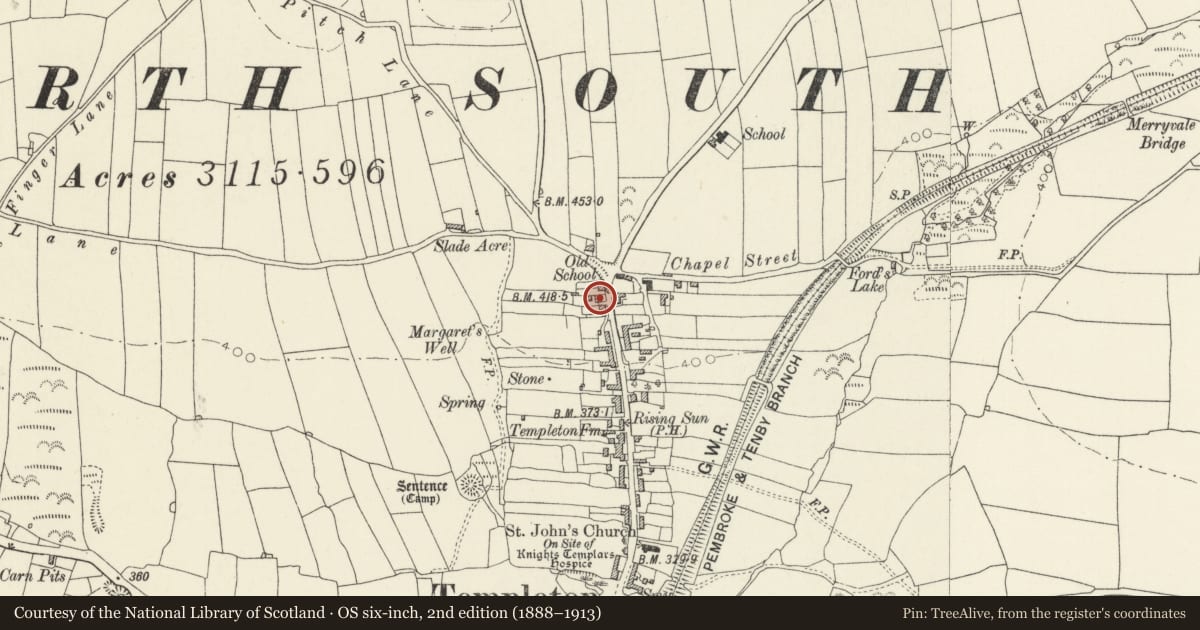
Slide toward Today to fade the historical sheet and see the modern map underneath.
David Rumsey Map Collection, Stanford LibrariesDavid Rumsey Map Collection, Stanford LibrariesDavid Rumsey Map Collection, Stanford LibrariesDavid Rumsey Map Collection, Stanford LibrariesDavid Rumsey Map Collection, Stanford Libraries
5 historical maps cover this location, the earliest the 1636 map "Cornubia : Devonia, Somersetus, Dorcestria, Wiltonia, Glocestria ..." (David Rumsey Map Collection, Stanford Libraries).
Historical maps covering this location
- 1636 · Cornubia : Devonia, Somersetus, Dorcestria, Wiltonia, Glocestria ... (David Rumsey Map Collection, Stanford Libraries)
- 1830 · V.3:11-15:XV. Britisches Reich. A. Kon: England. b. Frstenthum Wales: Shire: 37-40 (David Rumsey Map Collection, Stanford Libraries)
- 1891 · Sheet 10. Ordnance Survey of England and Wales. . (David Rumsey Map Collection, Stanford Libraries)
- 1898 · 228 Haverfordwest (Hills) (David Rumsey Map Collection, Stanford Libraries)
- 1901 · Sheet 13. (David Rumsey Map Collection, Stanford Libraries)
Cadw's description
Location
At N end of Templeton Village, set slightly back at W side of village street. Rubble stone front wall with gate piers and simple iron gate.
History
A cottage probably built about the time of the Narberth Enclosure, c.1786; it has a later (mid-C19) rear wing. It was until recently part of the Henllan estate. At one time it was occupied by the minister of the nearby Congregational chapel.
Exterior
Symmetrical front elevation of two storeys, three windows, facing E to the village street, but set back behind a small front garden. White-painted rubble front. The S side and the two-storey rear wing are rendered, the N gable and a single storey rear outshut unrendered. Slate roof, with brick end-chimneys. Twelve-pane sash windows at front with slightly cambered heads, the upper windows being very slightly smaller than the lower. Plain central front door, with a hood supported on struts.
Interior
Central hallway with dogleg staircase: close string, square balusters, pine handrail swept up to the landing newel. Decorative bottom newel. Four-panel doors. Small open fireplace in the left front room, a former kitchen; boarded rear door to extension.
Reason for designation
Well preserved late C18 vernacular house, retaining scale and proportion, with original plan form and some detail.
Nearby in the register
- Templeton FarmhouseDomesticunder 1 mi
- Sentence Castle MoundMotteunder 1 mi
- Poyer's FarmhouseDomesticunder 1 mi
- Milepost South of Templeton VillageTransportunder 1 mi
Other entries of the same register within about three miles of this one, by straight line.