Cof Cymru: National Historic Assets of Wales · Wales
Group of 3 table tombs in Coychurch churchyard adjoining S porch
Coychurch Lower, Bridgend, Wales
A Grade II listed building in Coychurch, Coychurch Lower, Bridgend, designated on 15 October 1997.
The record
- Designation
- Listed building, Grade II
- Broad class
- Religious, Ritual and Funerary
- Date of designation
- 15 October 1997
- Locality
- Coychurch
- Community
- Coychurch Lower
- Unitary authority
- Bridgend
- Country
- Wales
- Coordinates
- 51.50609, -3.52939
- Cadw reference
- 18966
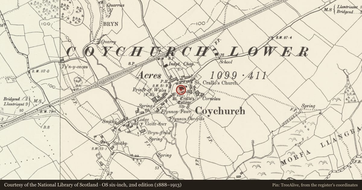
Slide toward Today to fade the historical sheet and see the modern map underneath.
David Rumsey Map Collection, Stanford LibrariesDavid Rumsey Map Collection, Stanford LibrariesDavid Rumsey Map Collection, Stanford LibrariesDavid Rumsey Map Collection, Stanford LibrariesDavid Rumsey Map Collection, Stanford Libraries
5 historical maps cover this location, the earliest the 1636 map "Cornubia : Devonia, Somersetus, Dorcestria, Wiltonia, Glocestria ..." (David Rumsey Map Collection, Stanford Libraries).
Historical maps covering this location
- 1636 · Cornubia : Devonia, Somersetus, Dorcestria, Wiltonia, Glocestria ... (David Rumsey Map Collection, Stanford Libraries)
- 1637 · The fourth table of England. Cornub. Devonia, Somerset etc. (David Rumsey Map Collection, Stanford Libraries)
- 1865 · England and Wales. England No. 6. (David Rumsey Map Collection, Stanford Libraries)
- 1897 · 262 Pontypridd (Hills) (David Rumsey Map Collection, Stanford Libraries)
- 1897 · 262 Pontypridd (Outline) (David Rumsey Map Collection, Stanford Libraries)
Cadw's description
Location
Situated close to the S porch of church of St Crallo and the churchyard cross, close together and just N of the path.
Exterior
Group of 3 table tombs of stone. Tomb nearest S door has an engraved stone slab commemorating Jenkin David of St Bride's Minor died 1812 and Margaret died 1830, with a later added inscription panel on W side, on an ashlar tomb chest. Pair of similar tombs just E of cross comprise a moulded slab, inscription panels on sides and decorative corners with fluting and roundels: that nearest S churchyard wall is to the Revd John Llewellyn of Marcross and curate of Coychurch parish died 1832; that between the other two has a long and mostly illegible inscription the initial part of which commemorates David Rhys of Tancoed died 1824.
Reason for designation
Listed especially for group value with the church of St Crallo and the churchyard cross, also the tombstone of Thomas Richards.
Nearby in the register
- Churchyard Cross in Coychurch ChurchyardReligious, Ritual and Funeraryunder 1 mi
- Coychurch Churchyard CrossCrossunder 1 mi
- Early Medieval Composite Pillar-Crosses at St Crallo’s Church, CoychurchCross shaftunder 1 mi
- Church of St CralloReligious, Ritual and Funeraryunder 1 mi
Other entries of the same register within about three miles of this one, by straight line.