Cof Cymru: National Historic Assets of Wales · Wales
Welsh Baptist Chapel
Denbigh, Denbighshire, Wales
A Grade II listed building in Denbigh - Lenten Pool, Denbigh, Denbighshire, designated on 30 September 1997.
The record
- Designation
- Listed building, Grade II
- Broad class
- Religious, Ritual and Funerary
- Date of designation
- 30 September 1997
- Locality
- Denbigh - Lenten Pool
- Community
- Denbigh
- Unitary authority
- Denbighshire
- Country
- Wales
- Coordinates
- 53.18394, -3.42409
- Cadw reference
- 18953
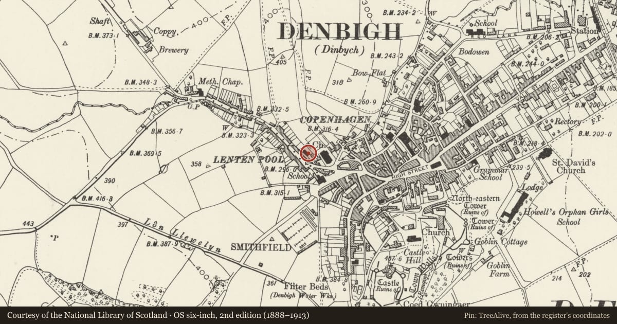
Slide toward Today to fade the historical sheet and see the modern map underneath.
David Rumsey Map Collection, Stanford LibrariesLlyfrgell Genedlaethol Cymru – The National Library of WalesDavid Rumsey Map Collection, Stanford LibrariesDavid Rumsey Map Collection, Stanford LibrariesDavid Rumsey Map Collection, Stanford Libraries
5 historical maps cover this location, the earliest the 1608 map "(13) Cambriae Typus." (David Rumsey Map Collection, Stanford Libraries).
Historical maps covering this location
- 1608 · (13) Cambriae Typus. (David Rumsey Map Collection, Stanford Libraries)
- 1795 · To Sir Watkin Williams-Wynn Bart ... the map of the six counties of North Wales is most… (Llyfrgell Genedlaethol Cymru – The National Library of Wales)
- 1830 · V.3:11-15:XV. Britisches Reich. A. Kon: England. b. Frstenthum Wales: Shire: 37-40 (David Rumsey Map Collection, Stanford Libraries)
- 1883 · Watershed map England, Wales 3. (David Rumsey Map Collection, Stanford Libraries)
- 1901 · Sheet 9 and 10. (David Rumsey Map Collection, Stanford Libraries)
Cadw's description
Location
Prominently sited on Henllan Street (on the W side of the town), set back from the road behind a partly-grassed, walled forecourt.
History
A plaque above the entrance records building activity in 1812, 1836, 1884, and 1927; but much of the character relates to the 1836 date.
Exterior
Two-storey chapel with brown brick facade and limestone rubble side and rear elevations; some stone dressings, slate roof. Symmetrical three-window brick facade with gable treated as a pediment. Round arched windows with small-pane glazing and marginal bars, stone sills; central arched doorway with panelled double-leaf doors. Side elevations of 2 windows, on 2 levels, camber-headed windows with small-pane glazing and marginal bars. To the rear is a single-storey extension; above this, 2 round-arched windows as before.
Interior
The interior retains its gallery.
Reason for designation
Listed for its special interest as a second-quarter C19 chapel retaining good original character.
Nearby in the register
- St Mary's ChurchReligious, Ritual and Funeraryunder 1 mi
- Bron HaulDomesticunder 1 mi
- Former Primary SchoolEducationunder 1 mi
- Bryn CelynDomesticunder 1 mi
Other entries of the same register within about three miles of this one, by straight line.