Cof Cymru: National Historic Assets of Wales · Wales
Pentre Brain
Llanddewi Brefi, Ceredigion, Wales
A Grade II listed building in Gogoyan, Llanddewi Brefi, Ceredigion, designated on 30 September 1997.
The record
- Designation
- Listed building, Grade II
- Broad class
- Domestic
- Date of designation
- 30 September 1997
- Locality
- Gogoyan
- Community
- Llanddewi Brefi
- Unitary authority
- Ceredigion
- Country
- Wales
- Coordinates
- 52.17844, -3.99699
- Cadw reference
- 18948
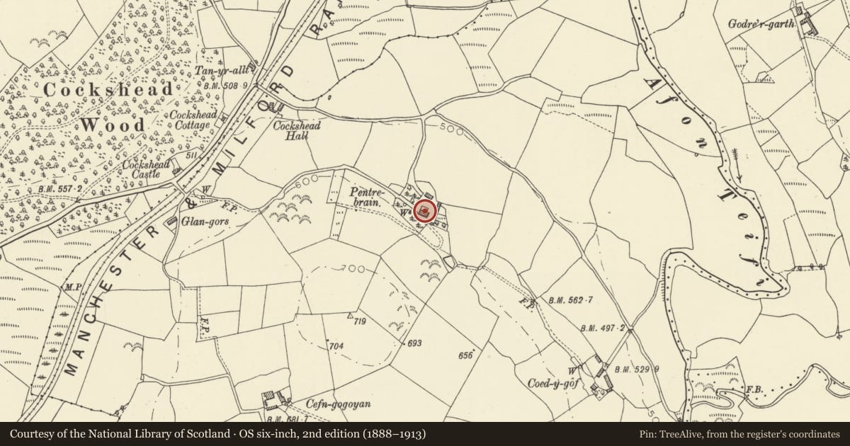
Slide toward Today to fade the historical sheet and see the modern map underneath.
David Rumsey Map Collection, Stanford LibrariesDavid Rumsey Map Collection, Stanford LibrariesDavid Rumsey Map Collection, Stanford LibrariesDavid Rumsey Map Collection, Stanford LibrariesDavid Rumsey Map Collection, Stanford Libraries
5 historical maps cover this location, the earliest the 1608 map "(13) Cambriae Typus." (David Rumsey Map Collection, Stanford Libraries).
Historical maps covering this location
- 1608 · (13) Cambriae Typus. (David Rumsey Map Collection, Stanford Libraries)
- 1830 · V.3:11-15:XV. Britisches Reich. A. Kon: England. b. Frstenthum Wales: Shire: 37-40 (David Rumsey Map Collection, Stanford Libraries)
- 1899 · 195 Lampeter (Hills) (David Rumsey Map Collection, Stanford Libraries)
- 1901 · Sheet 14. (David Rumsey Map Collection, Stanford Libraries)
- 1919 · Sheet 78. Lampeter. (David Rumsey Map Collection, Stanford Libraries)
Cadw's description
Location
Situated some 1.2 km N of Pont Gogoyan on W side of road running N to A 485, approached by drive running uphill from junction some 450m E of A 487.
History
Farmhouse dated 1852, built for David Walters.
Exterior
Colourwashed rubble stone with slate roofs, and stone end stacks. Two-storey, three-window main range, offset to right. Hornless 12-pane sashes with stone slab lintels and sills. Door of 6 flush panels and traceried overlight. Plaque affixed above door, 'David Walters built this house in the year 1852'. Small loft light on right end wall and lean-to. Rear two 16-pane first floor sashes. Lower service range to front left with 9-pane sash to loft, 16-pane sash below and door to right. Left end large stone stack. Outside stone steps to loft door on end wall.
Interior
Main house has stone external walls only and plank partitions to centre passage and between front and rear rooms on both floors. Ground floor left kitchen has large stone flags and wide fireplace. Parlour to right has marble fireplace. 6-panel doors. Narrow rooms to rear. Boarded panelling to stair, stick balusters to loft stairs. Upstairs doors are plank, not panelled. Roof collar trusses are partly re-used.
Service wing has three heavy beams, upper floor is entered only from outside stairs.
Reason for designation
Listed as a completely unaltered mid C19 farmhouse, still in late Georgian style and now rare in this region.
Nearby in the register
- Pont GogoyanTransportunder 1 mi
- Roman Roads and Vicus W of Llanio Roman FortFortunder 1 mi
- Llanio Roman Fort and BathhouseFortunder 1 mi
- Burnt Mound North of GlanrhoccaBurnt Moundunder 1 mi
Other entries of the same register within about three miles of this one, by straight line.