Cof Cymru: National Historic Assets of Wales · Wales
Capel y Gladdfa
Pentir, Gwynedd, Wales
A Grade II listed building in Pentir, Bangor, Gwynedd, designated on 22 September 1997.
The record
- Designation
- Listed building, Grade II
- Broad class
- Religious, Ritual and Funerary
- Date of designation
- 22 September 1997
- Locality
- Pentir
- Town
- Bangor
- Community
- Pentir
- Unitary authority
- Gwynedd
- Country
- Wales
- Coordinates
- 53.18212, -4.13774
- Cadw reference
- 18928
Slide toward Today to fade the historical sheet and see the modern map underneath.
David Rumsey Map Collection, Stanford LibrariesDavid Rumsey Map Collection, Stanford LibrariesDavid Rumsey Map Collection, Stanford LibrariesDavid Rumsey Map Collection, Stanford LibrariesDavid Rumsey Map Collection, Stanford Libraries
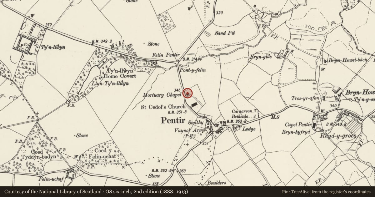
5 historical maps cover this location, the earliest the 1896 map "Sheet 7. Ordnance Survey of England and Wales." (David Rumsey Map Collection, Stanford Libraries).
Historical maps covering this location
- 1896 · Sheet 7. Ordnance Survey of England and Wales. (David Rumsey Map Collection, Stanford Libraries)
- 1899 · 106 Bangor (Hills) (David Rumsey Map Collection, Stanford Libraries)
- 1899 · 106 Bangor (Outline) (David Rumsey Map Collection, Stanford Libraries)
- 1901 · Sheet 9 and 10. (David Rumsey Map Collection, Stanford Libraries)
- 1919 · Sheet 41. Anglesey. (David Rumsey Map Collection, Stanford Libraries)
Cadw's description
Location
The chapel is located immediately outside the N boundary of the churchyard of the Church of St Cedol, at the N end of the village.
History
Erected in the mid C19, and after the completion of the adjacent church in 1848, to provide both for funerary use and to serve as a separate chapel for non-conformist worship.
Exterior
Green igneous rubble stonework, with rock-faced pale gritstone dressings, and a graded slate roof. A single cell building, with a gabled S porch near the W end. Lancet windows, paired at the W and centre of each side, and paired with a trefoiled roundel at the head at the E end with a pair of slit vents to the roof space. Two single lancets. Bracketed eaves and chamfered plinth. Coped gables; that at the E crowned with a metal cross. Diamond leaded glazing with red-flashed margins.
The access from the road is by a 'kissing gate' in a high half-round boulder wall and square gate piers.
Interior
Not accessible at the time of inspection.
Reason for designation
Included as a good example of this rare building type, and of group value with the Eglwys Sant Cedol immediately to the S.
Nearby in the register
- Eglwys Sant CedolReligious, Ritual and Funeraryunder 1 mi
- Pont-y-felinTransportunder 1 mi
- Milestone opposite Bryn goleuTransportunder 1 mi
- Ty'n Llwyn Farm - Detached barn outside Yard to EAgriculture and Subsistenceunder 1 mi
Other entries of the same register within about three miles of this one, by straight line.