Cof Cymru: National Historic Assets of Wales · Wales
Entrance gateway to St.James's Church
Pontymoile, Torfaen, Wales
A Grade II listed building in Pontypool, Pontymoile, Torfaen, designated on 28 August 1997.
The record
- Designation
- Listed building, Grade II
- Broad class
- Religious, Ritual and Funerary
- Date of designation
- 28 August 1997
- Locality
- Pontypool
- Town
- Pontypool
- Community
- Pontymoile
- Unitary authority
- Torfaen
- Country
- Wales
- Coordinates
- 51.70132, -3.03963
- Cadw reference
- 18826
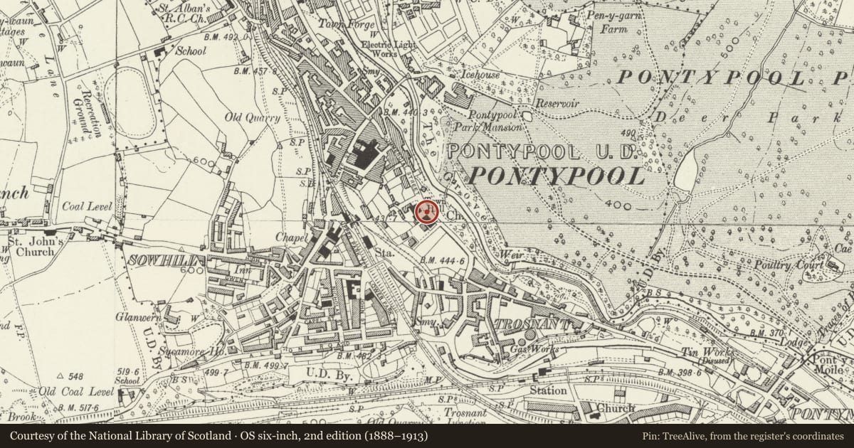
Slide toward Today to fade the historical sheet and see the modern map underneath.
David Rumsey Map Collection, Stanford LibrariesDavid Rumsey Map Collection, Stanford LibrariesDavid Rumsey Map Collection, Stanford LibrariesDavid Rumsey Map Collection, Stanford LibrariesDavid Rumsey Map Collection, Stanford Libraries
5 historical maps cover this location, the earliest the 1636 map "Cornubia : Devonia, Somersetus, Dorcestria, Wiltonia, Glocestria ..." (David Rumsey Map Collection, Stanford Libraries).
Historical maps covering this location
- 1636 · Cornubia : Devonia, Somersetus, Dorcestria, Wiltonia, Glocestria ... (David Rumsey Map Collection, Stanford Libraries)
- 1830 · V.3:11-15:XV.Britisches Reich. A. Kon: England. a. England ab sich: Shire:15-17, 33 (David Rumsey Map Collection, Stanford Libraries)
- 1895 · Sheet 11. Ordnance Survey of England and Wales. (David Rumsey Map Collection, Stanford Libraries)
- 1906 · 249 Newport (Hills) (David Rumsey Map Collection, Stanford Libraries)
- 1913 · Sheet 102. Newport. (David Rumsey Map Collection, Stanford Libraries)
Cadw's description
Location
In Pontypool town centre next to the Town Hall.
History
This gateway may date from the 1840's, before the rebuilding of the church in 1854, or may be contemporary with that; but the use of Greek Revival detail is more likely before the rebuilding when a consistent Gothic Revival would have been required.
Exterior
Limestone ashlar piers with cast-iron gates (one missing (11/1996). Greek Revival piers with block bases, pylon incised shafts and plain cornice and caps. The incised ornament echoes the decoration on the pilasters in the Council Chamber in the next door Town Hall. Decorative gate with row of quatrefoils at bottom and two larger ones in centre of gate.
Reason for designation
An attractively detailed mid C19 gateway which has important group value with the adjoining church and Town Hall.
Nearby in the register
- St. James's ChurchReligious, Ritual and Funeraryunder 1 mi
- Memorial gates, gate-piers and flanking quadrant screens to Pontypool Park.Commemorativeunder 1 mi
- Town HallCivilunder 1 mi
- Pontypool Public LibraryEducationunder 1 mi
Other entries of the same register within about three miles of this one, by straight line.