Cof Cymru: National Historic Assets of Wales · Wales
Barn at Wern Farm
New Inn, Torfaen, Wales
A Grade II listed building in Llanvihangel Pontymoel, Pontypool, New Inn, Torfaen, designated on 7 August 1997.
The record
- Designation
- Listed building, Grade II
- Broad class
- Agriculture and Subsistence
- Date of designation
- 7 August 1997
- Locality
- Llanvihangel Pontymoel
- Town
- Pontypool
- Community
- New Inn
- Unitary authority
- Torfaen
- Country
- Wales
- Coordinates
- 51.71120, -3.01290
- Cadw reference
- 18744
Slide toward Today to fade the historical sheet and see the modern map underneath.
David Rumsey Map Collection, Stanford LibrariesDavid Rumsey Map Collection, Stanford LibrariesDavid Rumsey Map Collection, Stanford LibrariesDavid Rumsey Map Collection, Stanford LibrariesDavid Rumsey Map Collection, Stanford Libraries
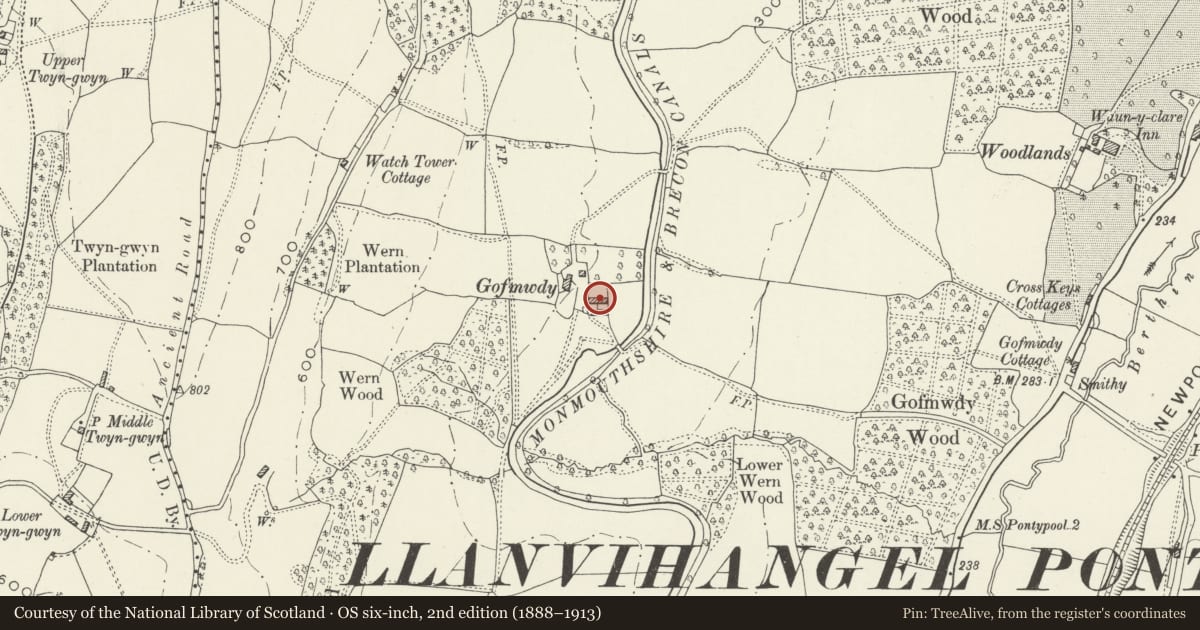
5 historical maps cover this location, the earliest the 1636 map "Cornubia : Devonia, Somersetus, Dorcestria, Wiltonia, Glocestria ..." (David Rumsey Map Collection, Stanford Libraries).
Historical maps covering this location
- 1636 · Cornubia : Devonia, Somersetus, Dorcestria, Wiltonia, Glocestria ... (David Rumsey Map Collection, Stanford Libraries)
- 1830 · V.3:11-15:XV.Britisches Reich. A. Kon: England. a. England ab sich: Shire:15-17, 33 (David Rumsey Map Collection, Stanford Libraries)
- 1895 · Sheet 11. Ordnance Survey of England and Wales. (David Rumsey Map Collection, Stanford Libraries)
- 1898 · 232 Abergavenny (Hills) (David Rumsey Map Collection, Stanford Libraries)
- 1913 · Sheet 102. Newport. (David Rumsey Map Collection, Stanford Libraries)
Cadw's description
Location
About 30m west of Wern Farmhouse.
History
A probably C17 combined barn and cowhouse. This building dates from before the acquisition of the farm by the Pontypool Park estate during the ownership of Capel Hanbury Leigh (1795-1861).
Exterior
Whitewashed rubble stone with Welsh slate roof with ridge tiles. Long narrow rectangular range with cowhouse at the west end and barn beyond. The gable end has a small window to the cowhouse and a taking-in door to the hayloft above and a small opening in the gable. The south elevation has two doors to the cowhouse and two large barn doors beyond.
Interior
Interior not inspected at the time of resurvey (December 1996).
Reason for designation
Included as a good example of a C17 combined barn and cowhouse which also has significant group value with Wern Farmhouse.
Nearby in the register
- Wern FarmhouseDomesticunder 1 mi
- Pigsty at Wern FarmAgriculture and Subsistenceunder 1 mi
- Bridge 57, Monmouthshire and Brecon CanalTransportunder 1 mi
- Barn at Ty-poeth FarmAgriculture and Subsistenceunder 1 mi
Other entries of the same register within about three miles of this one, by straight line.