Cof Cymru: National Historic Assets of Wales · Wales
Lodge to Bryngwenallt
Abergele, Conwy, Wales
A Grade II listed building in Abergele, Conwy, designated on 5 August 1997.
The record
- Designation
- Listed building, Grade II
- Broad class
- Domestic
- Date of designation
- 5 August 1997
- Locality
- Abergele
- Town
- Abergele
- Community
- Abergele
- Unitary authority
- Conwy
- Country
- Wales
- Coordinates
- 53.27487, -3.58521
- Cadw reference
- 18716
Slide toward Today to fade the historical sheet and see the modern map underneath.
David Rumsey Map Collection, Stanford LibrariesDavid Rumsey Map Collection, Stanford LibrariesDavid Rumsey Map Collection, Stanford LibrariesLlyfrgell Genedlaethol Cymru – The National Library of WalesDavid Rumsey Map Collection, Stanford Libraries
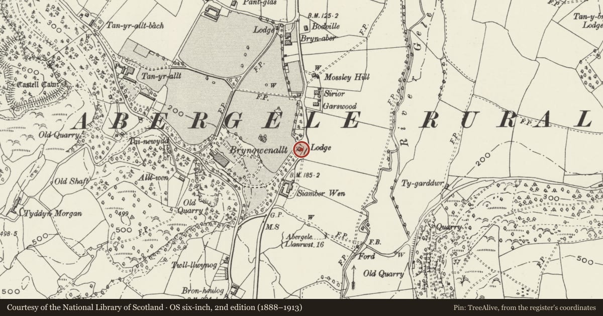
5 historical maps cover this location, the earliest the 1795 map "To Sir Watkin Williams-Wynn Bart ... the map of the six counties of North Wales is most humbly inscribed by his obedient humble servant" (Llyfrgell Genedlaethol Cymru – The National Library of Wales).
Historical maps covering this location
- 1795 · To Sir Watkin Williams-Wynn Bart ... the map of the six counties of North Wales is most… (Llyfrgell Genedlaethol Cymru – The National Library of Wales)
- 1830 · V.3:11-15:XV. Britisches Reich. A. Kon: England. b. Frstenthum Wales: Shire: 37-40 (David Rumsey Map Collection, Stanford Libraries)
- 1883 · Watershed map England, Wales 3. (David Rumsey Map Collection, Stanford Libraries)
- 1898 · 95 Rhyl (Hills) (David Rumsey Map Collection, Stanford Libraries)
- 1901 · Sheet 9 and 10. (David Rumsey Map Collection, Stanford Libraries)
Cadw's description
Location
The lodge is located close to the road, at the bottom of the driveway that winds up through the gardens to Bryngwenallt.
History
Built c1867 by Richard Owens, architect of Liverpool, for the industrialist John Roberts. Richard Owens had been surveyor to his father, David Roberts, before starting his own practice which specialised in chapel building. Bryngwenallt is a rare surviving example of a domestic building by this prolific architect.
Exterior
Built of snecked ashlar limestone, with banded blue and green slate roofs with red ridge tiles. One storey and attic, 'T'-plan, with cross wing having a gabled end with a canted stone mullioned bay window overlooking the drive. Shallow square bay window to the first structural bay, and a door at the junction of the two wings. Steeply pitched roof with fretted bargeboards and terminal finials, and stone stacks.
Reason for designation
Included for group value with the contemporary Bryngwenallt which is a notable Victorian mansion.
Nearby in the register
- BryngwenalltDomesticunder 1 mi
- Tyddyn-MorganDomesticunder 1 mi
- Roberts Monument at Eglwys Mynydd SeionReligious, Ritual and Funeraryunder 1 mi
- Castell Cawr HillfortHillfortunder 1 mi
Other entries of the same register within about three miles of this one, by straight line.