Cof Cymru: National Historic Assets of Wales · Wales
Abergele and Pensarn Station, 'Up' Platform Building.
Abergele, Conwy, Wales
A Grade II listed building in Pensarn, Abergele, Conwy, designated on 5 August 1997.
The record
- Designation
- Listed building, Grade II
- Broad class
- Transport
- Date of designation
- 5 August 1997
- Locality
- Pensarn
- Town
- Abergele
- Community
- Abergele
- Unitary authority
- Conwy
- Country
- Wales
- Coordinates
- 53.29513, -3.58216
- Cadw reference
- 18704
Slide toward Today to fade the historical sheet and see the modern map underneath.
David Rumsey Map Collection, Stanford LibrariesDavid Rumsey Map Collection, Stanford LibrariesDavid Rumsey Map Collection, Stanford LibrariesLlyfrgell Genedlaethol Cymru – The National Library of WalesDavid Rumsey Map Collection, Stanford Libraries
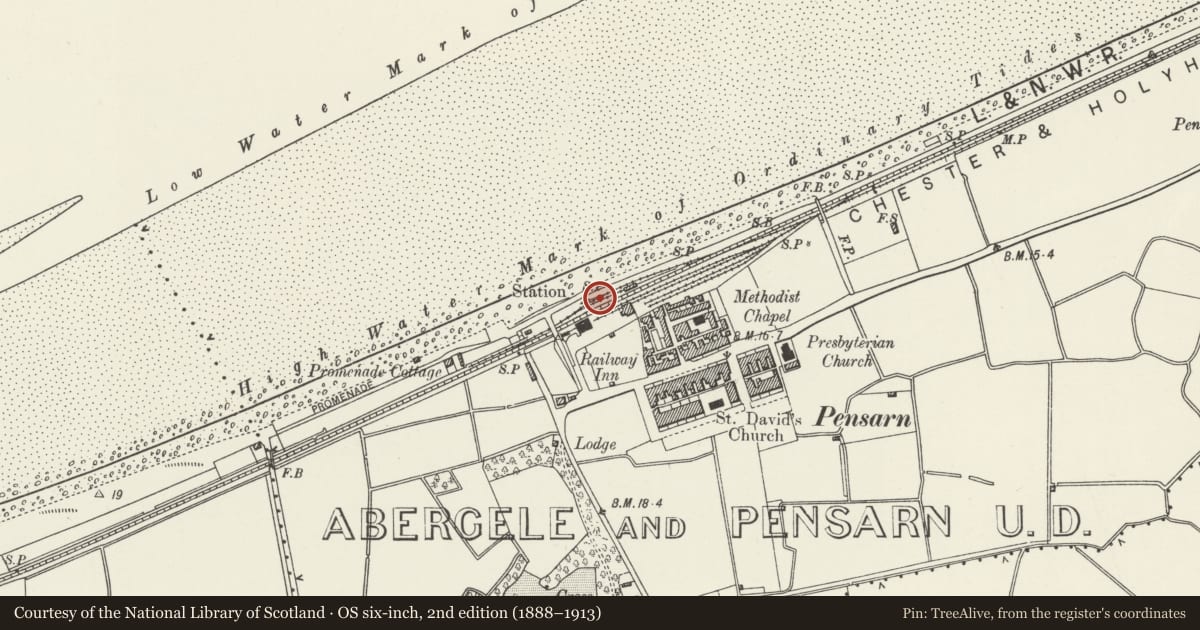
5 historical maps cover this location, the earliest the 1795 map "To Sir Watkin Williams-Wynn Bart ... the map of the six counties of North Wales is most humbly inscribed by his obedient humble servant" (Llyfrgell Genedlaethol Cymru – The National Library of Wales).
Historical maps covering this location
- 1795 · To Sir Watkin Williams-Wynn Bart ... the map of the six counties of North Wales is most… (Llyfrgell Genedlaethol Cymru – The National Library of Wales)
- 1830 · V.3:11-15:XV. Britisches Reich. A. Kon: England. b. Frstenthum Wales: Shire: 37-40 (David Rumsey Map Collection, Stanford Libraries)
- 1883 · Watershed map England, Wales 3. (David Rumsey Map Collection, Stanford Libraries)
- 1898 · 95 Rhyl (Hills) (David Rumsey Map Collection, Stanford Libraries)
- 1901 · Sheet 9 and 10. (David Rumsey Map Collection, Stanford Libraries)
Cadw's description
Location
The 'Up' platform building is on the N side of the track at Abergele Station, and is gained by a path from the overbridge to the W.
History
Probably built 1883 for the London and North Western Railway Company, for their improvments to the former Chester and Holyhead Railway station. The line at the rear, by the beach, was used for camping coaches.
Exterior
Buckley brindle brick with red brick dressings on a blue brick plinth. Slate roof. Six bays, with door in the second bay from each end. Detail as the 'Down' platform building. Roof hipped and gable stacks. An open roofed goods handling area at the W end, of timber framing, with a valenced flat roof supported on iron columns, and high level glazing on 2 sides.
Interior
Waiting room and cloakrooms.
Reason for designation
Included as one of a group of well preserved mid-later C19 railway station buildings.
Nearby in the register
- Abergele and Pensarn Station, 'Down' Platform BuildingTransportunder 1 mi
- Signal Box at Abergele and Pensarn Railway StationTransportunder 1 mi
- Abergele and Pensarn Railway Station Booking HallTransportunder 1 mi
- English Presbyterian ChurchReligious, Ritual and Funeraryunder 1 mi
Other entries of the same register within about three miles of this one, by straight line.