Cof Cymru: National Historic Assets of Wales · Wales
Ty-mawr Terrace
Abergele, Conwy, Wales
A Grade II listed building in Abergele, Conwy, designated on 5 August 1997.
The record
- Designation
- Listed building, Grade II
- Broad class
- Domestic
- Date of designation
- 5 August 1997
- Locality
- Abergele
- Town
- Abergele
- Community
- Abergele
- Unitary authority
- Conwy
- Country
- Wales
- Coordinates
- 53.28506, -3.58250
- Cadw reference
- 18701
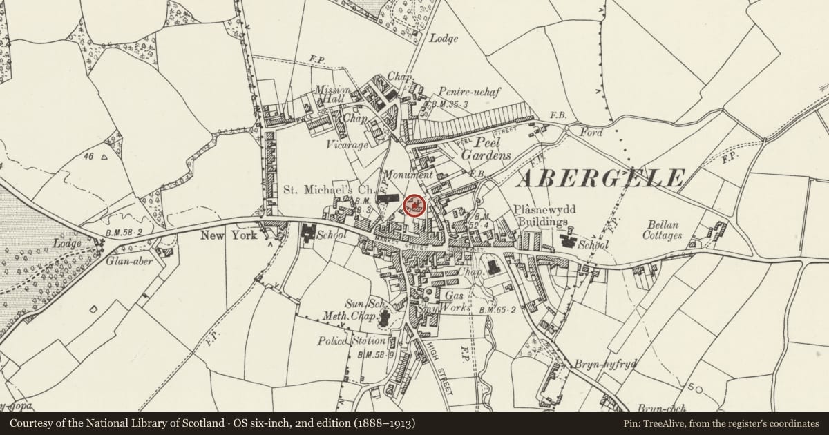
Slide toward Today to fade the historical sheet and see the modern map underneath.
David Rumsey Map Collection, Stanford LibrariesDavid Rumsey Map Collection, Stanford LibrariesDavid Rumsey Map Collection, Stanford LibrariesLlyfrgell Genedlaethol Cymru – The National Library of WalesDavid Rumsey Map Collection, Stanford Libraries
5 historical maps cover this location, the earliest the 1795 map "To Sir Watkin Williams-Wynn Bart ... the map of the six counties of North Wales is most humbly inscribed by his obedient humble servant" (Llyfrgell Genedlaethol Cymru – The National Library of Wales).
Historical maps covering this location
- 1795 · To Sir Watkin Williams-Wynn Bart ... the map of the six counties of North Wales is most… (Llyfrgell Genedlaethol Cymru – The National Library of Wales)
- 1830 · V.3:11-15:XV. Britisches Reich. A. Kon: England. b. Frstenthum Wales: Shire: 37-40 (David Rumsey Map Collection, Stanford Libraries)
- 1883 · Watershed map England, Wales 3. (David Rumsey Map Collection, Stanford Libraries)
- 1898 · 95 Rhyl (Hills) (David Rumsey Map Collection, Stanford Libraries)
- 1901 · Sheet 9 and 10. (David Rumsey Map Collection, Stanford Libraries)
Cadw's description
Location
Small N facing terrace leading W off the junction with Market Place, close to the Parish Church.
History
Ty Mawr Terrace is an example of mid C19 housing; not shown on the 1841 Tithe Map. It may originally have been a pair of 3-window cottages with the present difference in the breadth of the frontages being the result of a later alteration.
Exterior
No 3, at the W end of the terrace, is of 2 storeys, 2 bays, continuing the roughcast elevation of No 2. Rendered chimney stacks and horned 16 and 20-pane sash windows, those to the ground floor with segmental heads as on No 2. Central gabled late C19 porch with part-glazed door and overlight has been added.
Reason for designation
Included for group value with No 2 as one of a surviving pair of mid C19 town centre cottages.
Nearby in the register
- Ty-mawr TerraceDomesticunder 1 mi
- Church of St MichaelReligious, Ritual and Funeraryunder 1 mi
- Monument to the great rail disaster of 1868 in the Churchyard of Church of St MichaelReligious, Ritual and Funeraryunder 1 mi
- Lych Gate to Church of St MichaelReligious, Ritual and Funeraryunder 1 mi
Other entries of the same register within about three miles of this one, by straight line.