Cof Cymru: National Historic Assets of Wales · Wales
6A Church Street
Abergele, Conwy, Wales
A Grade II listed building in St George, Abergele, Conwy, designated on 5 August 1997.
The record
- Designation
- Listed building, Grade II
- Broad class
- Domestic
- Date of designation
- 5 August 1997
- Locality
- St George
- Town
- Abergele
- Community
- Abergele
- Unitary authority
- Conwy
- Country
- Wales
- Coordinates
- 53.26908, -3.54052
- Cadw reference
- 18673
Slide toward Today to fade the historical sheet and see the modern map underneath.
David Rumsey Map Collection, Stanford LibrariesDavid Rumsey Map Collection, Stanford LibrariesNational Library of ScotlandDavid Rumsey Map Collection, Stanford LibrariesLlyfrgell Genedlaethol Cymru – The National Library of Wales
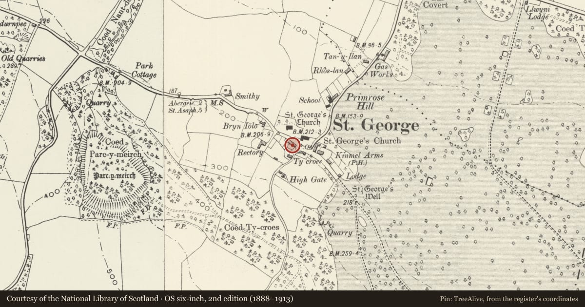
5 historical maps cover this location, the earliest the 1795 map "To Sir Watkin Williams-Wynn Bart ... the map of the six counties of North Wales is most humbly inscribed by his obedient humble servant" (Llyfrgell Genedlaethol Cymru – The National Library of Wales).
Historical maps covering this location
- 1795 · To Sir Watkin Williams-Wynn Bart ... the map of the six counties of North Wales is most… (Llyfrgell Genedlaethol Cymru – The National Library of Wales)
- 1883 · Watershed map England, Wales 3. (David Rumsey Map Collection, Stanford Libraries)
- 1898 · 95 Rhyl (Hills) (David Rumsey Map Collection, Stanford Libraries)
- 1901 · Sheet 9 and 10. (David Rumsey Map Collection, Stanford Libraries)
- 1963 · Map No. 36 - Local Government Commission for Wales : [Definitive maps showing proposed… (National Library of Scotland)
Cadw's description
Location
Located on the S side of the main street. No 6A is the second from the E end, on the curved section leading to the minor lane to the S.
History
The row of cottages is probably of C18 origin, and considerably altered in 1857 when they became estate dwellings for the Kinmel Estate.
Exterior
Belongs to a group of 5
Group
4, 5, 6, 6A and 7 Main Street, St George
Built of rubble stonework, now painted, with slate roofs. Each cottage is of one bay, with lateral door, and one 3-light window to the ground floor living room, its upper corners rounded, and set under a cambered flush relieving arch. On the upper floor, two small 2-light windows. Brick stacks on the party walls.
Reason for designation
Included as one of an important row of estate cottages of C18 origin, which form the core of St George village, a conservation area.
Nearby in the register
- 6 Church StreetDomesticunder 1 mi
- 7 Church StreetDomesticunder 1 mi
- 5 Church StreetDomesticunder 1 mi
- 4 Church StreetDomesticunder 1 mi
Other entries of the same register within about three miles of this one, by straight line.