Cof Cymru: National Historic Assets of Wales · Wales
Village Hall
Abergele, Conwy, Wales
A Grade II listed building in St George, Abergele, Conwy, designated on 5 August 1997.
The record
- Designation
- Listed building, Grade II
- Broad class
- Recreational
- Date of designation
- 5 August 1997
- Locality
- St George
- Town
- Abergele
- Community
- Abergele
- Unitary authority
- Conwy
- Country
- Wales
- Coordinates
- 53.26865, -3.53894
- Cadw reference
- 18667
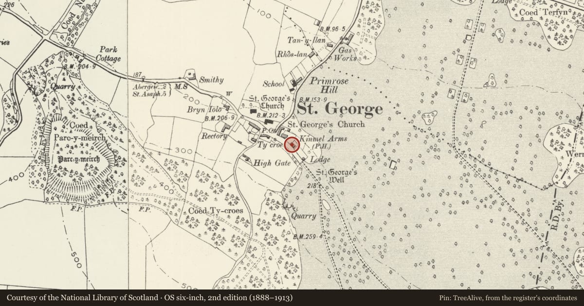
Slide toward Today to fade the historical sheet and see the modern map underneath.
David Rumsey Map Collection, Stanford LibrariesNational Library of ScotlandDavid Rumsey Map Collection, Stanford LibrariesLlyfrgell Genedlaethol Cymru – The National Library of WalesDavid Rumsey Map Collection, Stanford Libraries
5 historical maps cover this location, the earliest the 1795 map "To Sir Watkin Williams-Wynn Bart ... the map of the six counties of North Wales is most humbly inscribed by his obedient humble servant" (Llyfrgell Genedlaethol Cymru – The National Library of Wales).
Historical maps covering this location
- 1795 · To Sir Watkin Williams-Wynn Bart ... the map of the six counties of North Wales is most… (Llyfrgell Genedlaethol Cymru – The National Library of Wales)
- 1830 · V.3:11-15:XV. Britisches Reich. A. Kon: England. b. Frstenthum Wales: Shire: 37-40 (David Rumsey Map Collection, Stanford Libraries)
- 1883 · Watershed map England, Wales 3. (David Rumsey Map Collection, Stanford Libraries)
- 1901 · Sheet 9 and 10. (David Rumsey Map Collection, Stanford Libraries)
- 1963 · Map No. 36 - Local Government Commission for Wales : [Definitive maps showing proposed… (National Library of Scotland)
Cadw's description
Location
The building stands at the NW entrance of Kinmel Park, on the extension of the main street of the village.
History
Built in 1899 to provide a village meeting hall and schoolroom for the estate village of St George, a gift of Lady Florentia Hughes of Kinmel Hall.
Exterior
Built in local stone, with ashlar dressings and a slate roof. Tall facade of 1 storey. Four window bays, comprising 2-light mullioned and transomed windows with Tudor arched heads to each light, the glazing leaded, all under a continuous label moulding. Coped gables rising from kneelers, to brick gable stacks. Heraldic panel emblazoned with Hughes/Lewis impaling Ravensworth, with the initials FH and motto between the centre windows. At each end, a low entrance porch set flush with the facade, and 3-light windows in the gable ends.
Interior
The E entrance leads to a stair to the lower floor at the rear.
Reason for designation
Included as a well-proportioned building, set at the park entrance in the estate village of St George, and of group value with neighbouring listed buildings.
Nearby in the register
- Kinmel ArmsCommercialunder 1 mi
- St George Gate Lodge to Kinmel ParkGardens, Parks and Urban Spacesunder 1 mi
- Park Gates and Gatepiers to the NW entrance to Kinmel ParkGardens, Parks and Urban Spacesunder 1 mi
- Telephone Call-box adjoining St George's HouseCommunicationsunder 1 mi
Other entries of the same register within about three miles of this one, by straight line.