Cof Cymru: National Historic Assets of Wales · Wales
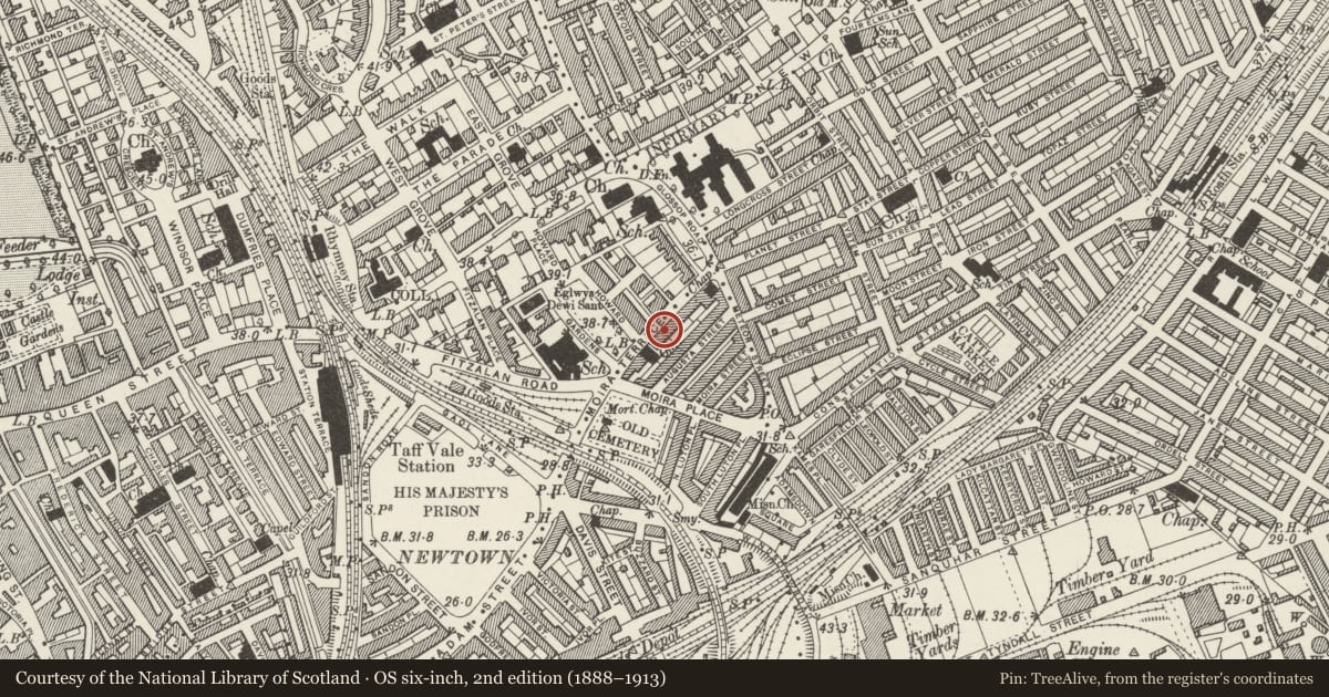
11 Moira Terrace
Adamsdown, Cardiff, Wales
A Grade II listed building in Adamsdown, Cardiff, designated on 31 July 1997.
The record
- Designation
- Listed building, Grade II
- Broad class
- Commercial
- Date of designation
- 31 July 1997
- Community
- Adamsdown
- Unitary authority
- Cardiff
- Country
- Wales
- Coordinates
- 51.48301, -3.16412
- Cadw reference
- 18647
Slide toward Today to fade the historical sheet and see the modern map underneath.
David Rumsey Map Collection, Stanford LibrariesDavid Rumsey Map Collection, Stanford LibrariesDavid Rumsey Map Collection, Stanford LibrariesDavid Rumsey Map Collection, Stanford LibrariesDavid Rumsey Map Collection, Stanford Libraries
5 historical maps cover this location, the earliest the 1636 map "Cornubia : Devonia, Somersetus, Dorcestria, Wiltonia, Glocestria ..." (David Rumsey Map Collection, Stanford Libraries).
Historical maps covering this location
- 1636 · Cornubia : Devonia, Somersetus, Dorcestria, Wiltonia, Glocestria ... (David Rumsey Map Collection, Stanford Libraries)
- 1865 · England and Wales. England No. 6. (David Rumsey Map Collection, Stanford Libraries)
- 1895 · Sheet 11. Ordnance Survey of England and Wales. (David Rumsey Map Collection, Stanford Libraries)
- 1898 · 263 Cardiff (Hills) (David Rumsey Map Collection, Stanford Libraries)
- 1913 · Sheet 110. Cardiff & Mouth of the Severn. (David Rumsey Map Collection, Stanford Libraries)
Cadw's description
Location
On S side of road.
History
Late C19 terrace of commercial premises with domestic accommodation above.
Late C19 and early C20 street directories show the terrace as being largely used by charitable organisations.
Exterior
9-22 Moira Terrace (inclusive)
Late C19 terrace of commercial premises with domestic accommodation above.
Three storeys, roughcast render and red brick, mainly sash glazing to upper floors, slate roofs, brick chimneys. 23 windows in all, at top floor level, central group of 7 windows in moulded architraves (central window paired), then to each side, group of 7 elliptical arches over alternating sash and square windows; ends of terrace have 2 windows as centre. On first floor, alternating sash windows and square oriel bay windows with iron brackets; sash glazing. On ground floor, shopfronts; those to L have tripartite mullioned windows.
Reason for designation
Listed as striking commercial/domestic terrace with interesting history.
Nearby in the register
- 12 Moira TerraceCommercialunder 1 mi
- 10 Moira TerraceCommercialunder 1 mi
- 9 Moira TerraceCommercialunder 1 mi
- 13/14 Moira TerraceCommercialunder 1 mi
Other entries of the same register within about three miles of this one, by straight line.