Cof Cymru: National Historic Assets of Wales · Wales
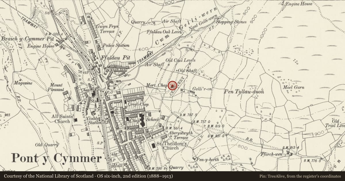
Mortuary Chapel
Garw Valley, Bridgend, Wales
A Grade II listed building in Pontycymer, Garw Valley, Bridgend, designated on 30 July 1997.
The record
- Designation
- Listed building, Grade II
- Broad class
- Religious, Ritual and Funerary
- Date of designation
- 30 July 1997
- Locality
- Pontycymer
- Community
- Garw Valley
- Unitary authority
- Bridgend
- Country
- Wales
- Coordinates
- 51.61158, -3.57924
- Cadw reference
- 18632
Slide toward Today to fade the historical sheet and see the modern map underneath.
David Rumsey Map Collection, Stanford LibrariesDavid Rumsey Map Collection, Stanford LibrariesDavid Rumsey Map Collection, Stanford LibrariesDavid Rumsey Map Collection, Stanford LibrariesDavid Rumsey Map Collection, Stanford Libraries
5 historical maps cover this location, the earliest the 1636 map "Cornubia : Devonia, Somersetus, Dorcestria, Wiltonia, Glocestria ..." (David Rumsey Map Collection, Stanford Libraries).
Historical maps covering this location
- 1636 · Cornubia : Devonia, Somersetus, Dorcestria, Wiltonia, Glocestria ... (David Rumsey Map Collection, Stanford Libraries)
- 1637 · The fourth table of England. Cornub. Devonia, Somerset etc. (David Rumsey Map Collection, Stanford Libraries)
- 1830 · V.3:11-15:XV. Britisches Reich. A. Kon: England. b. Frstenthum Wales: Shire: 37-40 (David Rumsey Map Collection, Stanford Libraries)
- 1865 · England and Wales. England No. 6. (David Rumsey Map Collection, Stanford Libraries)
- 1907 · 248 Pontypridd (Hills) (David Rumsey Map Collection, Stanford Libraries)
Cadw's description
Location
Situated on the hillside on the eastern edge of the town.
History
Pontycymmer Cemetery was established 1888 under control of Llangeinor Burial Board.
Exterior
A simple small single cell main building with high S porch. Built of snecked rock-faced sandstone with ashlar dressings, banded Welsh slate roof, blue ridge tiles and small ashlar gabled bellcote on E apex. The approach from S is dominated by the steeply gabled porch with its unmoulded pointed arched doorway of ashlar with narrow rock-faced voussoir band; elegant decorative wrought iron gate of Art Nouveau motif with spear finials; inner doorway is square headed with moulded ashlar surround and relieving arch above, and double black painted boarded doors. Windows only to E and W are of 2 pointed lights with a triangular light in apex. Tiered angle buttresses at each corner.
Interior
Retains stone flagged floor and open timber roof.
Reason for designation
Listed as an unaltered late C19 mortuary chapel of simple but effective design, with good ironwork and for group value with the Cemetery Entrance and the monument to Benjamin Noyle.
Nearby in the register
- Monument to Benjamin and Elizabeth Noyle, Pontycymmer CemeteryReligious, Ritual and Funeraryunder 1 mi
- Pontycymer Cemetery EntranceReligious, Ritual and Funeraryunder 1 mi
- United Reformed Church including vestry wingReligious, Ritual and Funeraryunder 1 mi
- Tabernacl Capel yr Annibynwyr (Welsh Independent) including vestry wingReligious, Ritual and Funeraryunder 1 mi
Other entries of the same register within about three miles of this one, by straight line.