Cof Cymru: National Historic Assets of Wales · Wales
Cefn-y-coed-uchaf
Bontnewydd, Gwynedd, Wales
A Grade II listed building in Llanfaglan, Caernarfon, Bontnewydd, Gwynedd, designated on 29 July 1997.
The record
- Designation
- Listed building, Grade II
- Broad class
- Domestic
- Date of designation
- 29 July 1997
- Locality
- Llanfaglan
- Town
- Caernarfon
- Community
- Bontnewydd
- Unitary authority
- Gwynedd
- Country
- Wales
- Coordinates
- 53.12294, -4.29247
- Cadw reference
- 18622
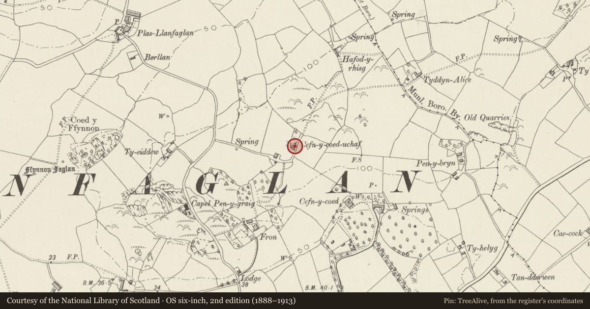
Slide toward Today to fade the historical sheet and see the modern map underneath.
David Rumsey Map Collection, Stanford LibrariesDavid Rumsey Map Collection, Stanford LibrariesDavid Rumsey Map Collection, Stanford LibrariesDavid Rumsey Map Collection, Stanford LibrariesDavid Rumsey Map Collection, Stanford Libraries
5 historical maps cover this location, the earliest the 1883 map "Watershed map England, Wales 3." (David Rumsey Map Collection, Stanford Libraries).
Historical maps covering this location
- 1883 · Watershed map England, Wales 3. (David Rumsey Map Collection, Stanford Libraries)
- 1896 · Sheet 7. Ordnance Survey of England and Wales. (David Rumsey Map Collection, Stanford Libraries)
- 1899 · 105 Carnarvon (Hills) (David Rumsey Map Collection, Stanford Libraries)
- 1901 · Sheet 9 and 10. (David Rumsey Map Collection, Stanford Libraries)
- 1919 · Sheet 41. Anglesey. (David Rumsey Map Collection, Stanford Libraries)
Cadw's description
Location
Situated at the end of a minor road some 850m NNE of the church in Llanfaglan.
History
Early C19 farmhouse, originally and latterly part of the Cefn-y-coed estate. The Llanfaglan Tithe Map of 1843 shows a property of approximately 7 acres (2.8ha), occupied by Henry Jones and owned by Gwilym Lloyd Wardle.
Exterior
Rubble stone of rough boulders, with slate close-eaved roof and stone end stacks, larger to left. Two storey, three-window range, offset to right. Twelve-pane sashes with slate lintels and centre boarded door with 4-pane overlight. Added rendered lean-to on left end wall. Rear two windows to first floor centre and right, very small window to ground floor left. Single-storey wing to right, rubble stone walls, slate roof and end stone stack, raised in brick. Twelve-pane window and boarded door.
Interior
Not inspected but said to have heavily beamed ceiling and inglenook fireplace.
Reason for designation
Included as a well-preserved example of a substantial early C19 vernacular farmhouse of the region.
Nearby in the register
- Cefn-y-coedDomesticunder 1 mi
- Free HolderDomesticunder 1 mi
- Lychgate, stable and churchyard wall of the Church of Saint Baglan.Religious, Ritual and Funeraryunder 1 mi
- Church of St BaglanReligious, Ritual and Funeraryunder 1 mi
Other entries of the same register within about three miles of this one, by straight line.