Cof Cymru: National Historic Assets of Wales · Wales
Bryn Lwyd
Menai Bridge, Isle of Anglesey, Wales
A Grade II listed building in Menai Bridge, Isle of Anglesey, designated on 18 July 1997.
The record
- Designation
- Listed building, Grade II
- Broad class
- Domestic
- Date of designation
- 18 July 1997
- Town
- Menai Bridge
- Community
- Menai Bridge
- Unitary authority
- Isle of Anglesey
- Country
- Wales
- Coordinates
- 53.22426, -4.16447
- Cadw reference
- 18569
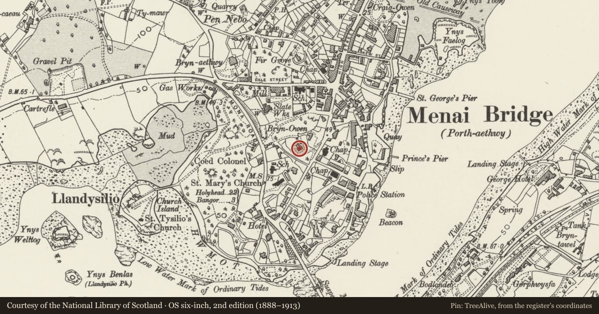
Slide toward Today to fade the historical sheet and see the modern map underneath.
David Rumsey Map Collection, Stanford LibrariesDavid Rumsey Map Collection, Stanford LibrariesDavid Rumsey Map Collection, Stanford LibrariesDavid Rumsey Map Collection, Stanford LibrariesDavid Rumsey Map Collection, Stanford Libraries
5 historical maps cover this location, the earliest the 1896 map "Sheet 7. Ordnance Survey of England and Wales." (David Rumsey Map Collection, Stanford Libraries).
Historical maps covering this location
- 1896 · Sheet 7. Ordnance Survey of England and Wales. (David Rumsey Map Collection, Stanford Libraries)
- 1899 · 106 Bangor (Outline) (David Rumsey Map Collection, Stanford Libraries)
- 1899 · 106 Bangor (Hills) (David Rumsey Map Collection, Stanford Libraries)
- 1901 · Sheet 9 and 10. (David Rumsey Map Collection, Stanford Libraries)
- 1919 · Sheet 41. Anglesey. (David Rumsey Map Collection, Stanford Libraries)
Cadw's description
Location
In an elevated position set above the NW side of Bridge Street opposite the English Presbyterian Chapel.
History
Mid - late C19.
Exterior
Simplified Italianate-style villa; 2 storeyed with principal elevation a 4 window range to left, advanced bay to right. Stucco rendered with strongly moulded dressings, including eaves cornice, stressed angle quoins, string course and sill band to first floor windows. Hipped slate roof with rendered stacks to either end. Windows are 2-pane sashes in moulded architraves with stressed keystones. Full-height squared bay to right with tripartite sashes in each floor, the ground floor windows pedimented on moulded brackets. Entrance is through panelled double door to rear, right of the single storey extension to rear.
Reason for designation
Listed as retaining its character as a well proportioned villa which is good later example of the type of development which characterised the growth of the town following the building of the Menai Suspension Bridge in 1826.
Nearby in the register
- English Presbyterian ChapelReligious, Ritual and Funeraryunder 1 mi
- St. Mary's ChurchReligious, Ritual and Funeraryunder 1 mi
- Victoria HotelCommercialunder 1 mi
- Capel Mawr Chapel HouseReligious, Ritual and Funeraryunder 1 mi
Other entries of the same register within about three miles of this one, by straight line.