Cof Cymru: National Historic Assets of Wales · Wales
Bridge 144 over the Montgomeryshire Canal
Llandyssil, Powys, Wales
A Grade II listed building in Glanhafren, Llandyssil, Powys, designated on 14 July 1997.
The record
- Designation
- Listed building, Grade II
- Broad class
- Transport
- Date of designation
- 14 July 1997
- Locality
- Glanhafren
- Community
- Llandyssil
- Unitary authority
- Powys
- Country
- Wales
- Coordinates
- 52.55597, -3.23198
- Cadw reference
- 18529
Slide toward Today to fade the historical sheet and see the modern map underneath.
David Rumsey Map Collection, Stanford LibrariesDavid Rumsey Map Collection, Stanford LibrariesDavid Rumsey Map Collection, Stanford LibrariesLlyfrgell Genedlaethol Cymru – The National Library of WalesDavid Rumsey Map Collection, Stanford Libraries
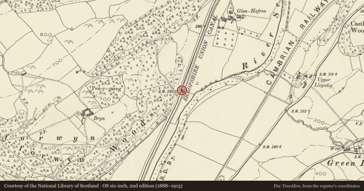
5 historical maps cover this location, the earliest the 1637 map "Particular description of Wales. Cambria seu Wallia" (David Rumsey Map Collection, Stanford Libraries).
Historical maps covering this location
- 1637 · Particular description of Wales. Cambria seu Wallia (David Rumsey Map Collection, Stanford Libraries)
- 1795 · To Sir Watkin Williams-Wynn Bart ... the map of the six counties of North Wales is most… (Llyfrgell Genedlaethol Cymru – The National Library of Wales)
- 1883 · Watershed map England, Wales 3. (David Rumsey Map Collection, Stanford Libraries)
- 1899 · 165 Montgomery (Hills) (David Rumsey Map Collection, Stanford Libraries)
- 1901 · Sheet 14. (David Rumsey Map Collection, Stanford Libraries)
Cadw's description
Location
The bridge carries a trackway over the canal and is located between Glanhafren and Brynderwen. It is immediately E of the A483 Welshpool to Newtown road.
History
One of three swing-bridges constructed over the Western branch of the Montgomeryshire Canal in the later C19. As there are also bridges of this type on the Eastern branch, they must post date the purchase of the canal by the Shropshire Union Railways and Canal Company in 1850.
Exterior
Slightly arched iron girder swing-bridge. The beams have an inverted T-section and support simple iron railings consisting of widely-spaced posts and a handrail. The bridge would have turned from the W side, as the curved moveable end (also iron faced) is visible to the E.
Reason for designation
A significant element in the later phase of structures associated with the Montgomeryshire Canal. One of three such swing-bridges on the Western branch.
Nearby in the register
- GlanhafrenDomesticunder 1 mi
- Bridge 143 over the Montgomeryshire CanalTransportunder 1 mi
- Bridge 145 over the Montgomeryshire CanalTransportunder 1 mi
- Dolforwyn Hall HotelDomesticunder 1 mi
Other entries of the same register within about three miles of this one, by straight line.