Cof Cymru: National Historic Assets of Wales · Wales
Old Library
Rhosddu, Wrexham, Wales
A Grade II listed building in Rhosddu, Wrexham, designated on 23 December 1975.
The record
- Designation
- Listed building, Grade II
- Broad class
- Recreational
- Date of designation
- 23 December 1975
- Community
- Rhosddu
- Unitary authority
- Wrexham
- Country
- Wales
- Coordinates
- 53.04701, -2.99358
- Cadw reference
- 1852
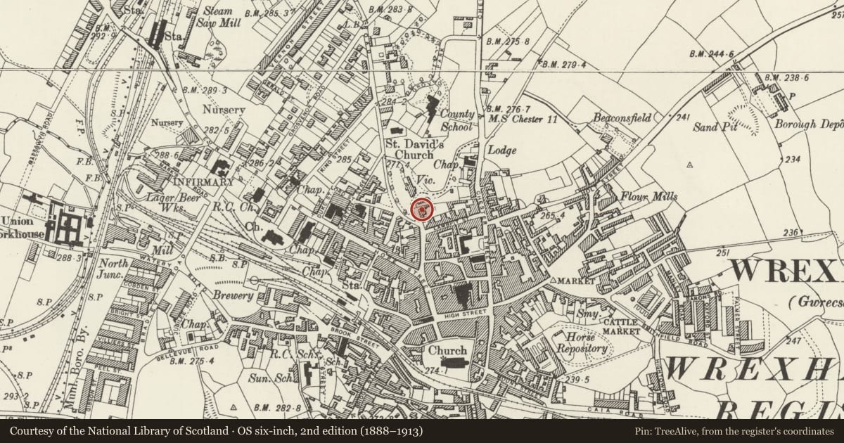
Slide toward Today to fade the historical sheet and see the modern map underneath.
David Rumsey Map Collection, Stanford LibrariesDavid Rumsey Map Collection, Stanford LibrariesDavid Rumsey Map Collection, Stanford LibrariesDavid Rumsey Map Collection, Stanford LibrariesDavid Rumsey Map Collection, Stanford Libraries
5 historical maps cover this location, the earliest the 1608 map "(13) Cambriae Typus." (David Rumsey Map Collection, Stanford Libraries).
Historical maps covering this location
- 1608 · (13) Cambriae Typus. (David Rumsey Map Collection, Stanford Libraries)
- 1883 · Watershed map England, Wales 3. (David Rumsey Map Collection, Stanford Libraries)
- 1898 · 121 Wrexham (Hills) (David Rumsey Map Collection, Stanford Libraries)
- 1898 · 121 Wrexham (Outline) (David Rumsey Map Collection, Stanford Libraries)
- 1901 · Sheet 9 and 10. (David Rumsey Map Collection, Stanford Libraries)
Cadw's description
Location
Facing down Queen Street and closing the view from Hope Street.
History
Built as a library and lecture hall in 1907 with funding from the Carnegie Trust to designs of Vernon Hodge, and enlarged in 1951. Council offices since 1973.
Exterior
Flemish bond brickwork with ashlar lower storey and dressings and graded slate roof. 2 storeys, the main block is a symetrical 5-window range in baroque style. Central bay stressed by pilasters to segmental open pediment, with coat of arms. Central entrance recessed in segmental archway with heavy keystone beneath steep pediment carried on heavy brackets. Iron gates enclose the porch. Arched lower storey, with segmentally arched tripartite small-paned windows with keystones to continuous hood moulds. Fenestration of upper storey forms a continuous band of 3-light mullioned windows, divided by wider panelled pilasters. Angle pilasters, and those articulating central bay have high relief cartouches beneath heavy modillion cornice which continues across the central pediment. The roof is surmounted by a small square-section cupola. Rear range has 6 sash windows, grouped in pairs. Later cross wing beyond.
Nearby in the register
- 1-3 Queen StreetCommercialunder 1 mi
- The Seven Stars Public HouseCommercialunder 1 mi
- The Old Registry OfficeDomesticunder 1 mi
- The Talbot Public HouseCommercialunder 1 mi
Other entries of the same register within about three miles of this one, by straight line.