Cof Cymru: National Historic Assets of Wales · Wales
Post Office
Maesteg, Bridgend, Wales
A Grade II listed building in Maesteg, Bridgend, designated on 14 July 1997.
The record
- Designation
- Listed building, Grade II
- Broad class
- Commercial
- Date of designation
- 14 July 1997
- Locality
- Maesteg
- Town
- Maesteg
- Community
- Maesteg
- Unitary authority
- Bridgend
- Country
- Wales
- Coordinates
- 51.60932, -3.65751
- Cadw reference
- 18504
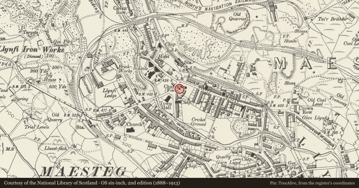
Slide toward Today to fade the historical sheet and see the modern map underneath.
David Rumsey Map Collection, Stanford LibrariesDavid Rumsey Map Collection, Stanford LibrariesDavid Rumsey Map Collection, Stanford LibrariesDavid Rumsey Map Collection, Stanford LibrariesDavid Rumsey Map Collection, Stanford Libraries
5 historical maps cover this location, the earliest the 1636 map "Cornubia : Devonia, Somersetus, Dorcestria, Wiltonia, Glocestria ..." (David Rumsey Map Collection, Stanford Libraries).
Historical maps covering this location
- 1636 · Cornubia : Devonia, Somersetus, Dorcestria, Wiltonia, Glocestria ... (David Rumsey Map Collection, Stanford Libraries)
- 1637 · The fourth table of England. Cornub. Devonia, Somerset etc. (David Rumsey Map Collection, Stanford Libraries)
- 1830 · V.3:11-15:XV. Britisches Reich. A. Kon: England. b. Frstenthum Wales: Shire: 37-40 (David Rumsey Map Collection, Stanford Libraries)
- 1865 · England and Wales. England No. 6. (David Rumsey Map Collection, Stanford Libraries)
- 1907 · 248 Pontypridd (Hills) (David Rumsey Map Collection, Stanford Libraries)
Cadw's description
Location
Located between St David's Church and the North Memorial Hall, facing the Town Hall square at the centre of Maesteg.
History
Built 1938 by Office of Works for the Royal Mail.
Exterior
Built of a brindled brick with Bath stone dressings,on a low granite plinth. Slate roof. The main elevation is symmetrical, of 5 bays, sweeping up to 3 bays at first floor level and an unmoulded pediment-gable. The central pilastered and pedimented doorcase has a narrow overlight and panelled doors. To either side, 20-pane sash windows with a pronounced stone keystone in a flat brick arch, and three similar 16-pane sash windows above. To the left of the elevation, brick piers with iron gates giving access to the rear yard.
Reason for designation
Included as a well proportioned example of the Ministry of Works Georgian revival, and to complete the group of significant listed buildings at the centre of Maesteg.
Nearby in the register
- Church of St David, and surrounding churchyard railed wall.Religious, Ritual and Funeraryunder 1 mi
- Colonel North Memorial HallRecreationalunder 1 mi
- CenotaphCommemorativeunder 1 mi
- William Hopkin Thomas memorial Lamp and fountain.Commemorativeunder 1 mi
Other entries of the same register within about three miles of this one, by straight line.