Cof Cymru: National Historic Assets of Wales · Wales
The Old Glyn
Bettws, Powys, Wales
A Grade II listed building in Ucheldre, Bettws, Powys, designated on 25 April 1997.
The record
- Designation
- Listed building, Grade II
- Broad class
- Domestic
- Date of designation
- 25 April 1997
- Locality
- Ucheldre
- Community
- Bettws
- Unitary authority
- Powys
- Country
- Wales
- Coordinates
- 52.57432, -3.27496
- Cadw reference
- 18422
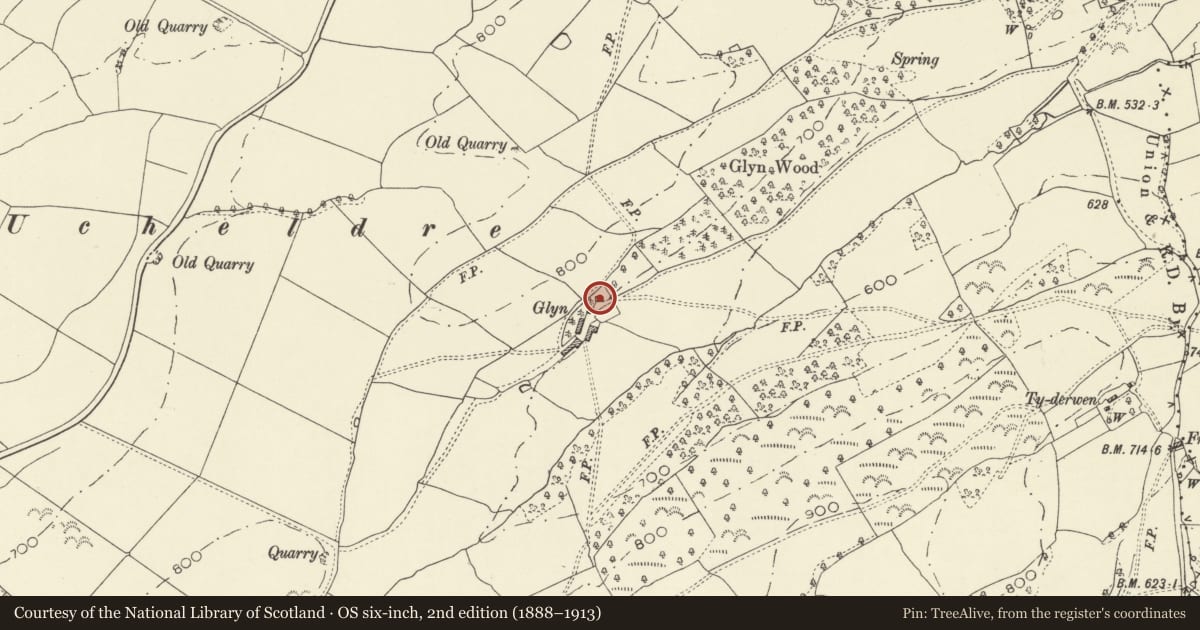
Slide toward Today to fade the historical sheet and see the modern map underneath.
David Rumsey Map Collection, Stanford LibrariesLlyfrgell Genedlaethol Cymru – The National Library of WalesDavid Rumsey Map Collection, Stanford LibrariesDavid Rumsey Map Collection, Stanford LibrariesDavid Rumsey Map Collection, Stanford Libraries
5 historical maps cover this location, the earliest the 1608 map "(13) Cambriae Typus." (David Rumsey Map Collection, Stanford Libraries).
Historical maps covering this location
- 1608 · (13) Cambriae Typus. (David Rumsey Map Collection, Stanford Libraries)
- 1637 · Particular description of Wales. Cambria seu Wallia (David Rumsey Map Collection, Stanford Libraries)
- 1795 · To Sir Watkin Williams-Wynn Bart ... the map of the six counties of North Wales is most… (Llyfrgell Genedlaethol Cymru – The National Library of Wales)
- 1830 · V.3:11-15:XV. Britisches Reich. A. Kon: England. b. Frstenthum Wales: Shire: 37-40 (David Rumsey Map Collection, Stanford Libraries)
- 1883 · Watershed map England, Wales 3. (David Rumsey Map Collection, Stanford Libraries)
Cadw's description
Location
Located approximately 1.9km NE of Bettws Cedewain church, and reached at the end of a track at the end of a farm road to Glyn Farm on S side of minor road between Bettws Cedewain and Brooks.
History
Small C17 2-unit, single-storey house enlarged by addition of a wing, and heightened in the C19 to 2 storeys by raising eaves of wing and inserting dormer to main range. Lean-to and outshot were also added at rear in the C19.
Exterior
Two-storey house consisting of a main range with wing to R. Timber framed in square panels with tension bracing (on a brick plinth) and slate roof with axial C19 brick stack over junction of 2 ranges. Doorway is to R in the gable end of main range, to L of which are 2x2-light casements, with single casement in the gable. The L side wall has similar casements, and a timber framed dormer. The wing has a 2-light casement to front, with a similar window in the added upper storey. The gable end to R has similar windows. (Roughcast lean-tos to main range and catslide roofed outshot to wing are C19).
Interior
Two-unit main range with lobby entry and fireplace in the lateral wall.
Nearby in the register
- Pen-y-Gaer CampHillfortunder 1 mi
- Ucheldre CampEnclosureunder 1 mi
- Pentre Llifior Methodist ChapelReligious, Ritual and Funeraryunder 1 mi
- Brynycil FarmhouseDomesticunder 1 mi
Other entries of the same register within about three miles of this one, by straight line.