Cof Cymru: National Historic Assets of Wales · Wales
Coetmor Farmhouse
Bethesda, Gwynedd, Wales
A Grade II listed building in Coetmor, Bangor, Bethesda, Gwynedd, designated on 25 April 1997.
The record
- Designation
- Listed building, Grade II
- Broad class
- Domestic
- Date of designation
- 25 April 1997
- Locality
- Coetmor
- Town
- Bangor
- Community
- Bethesda
- Unitary authority
- Gwynedd
- Country
- Wales
- Coordinates
- 53.18682, -4.06842
- Cadw reference
- 18397
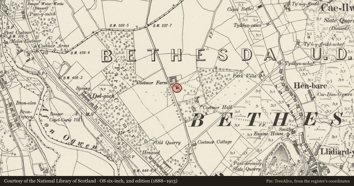
Slide toward Today to fade the historical sheet and see the modern map underneath.
David Rumsey Map Collection, Stanford LibrariesDavid Rumsey Map Collection, Stanford LibrariesDavid Rumsey Map Collection, Stanford LibrariesDavid Rumsey Map Collection, Stanford LibrariesDavid Rumsey Map Collection, Stanford Libraries
5 historical maps cover this location, the earliest the 1896 map "Sheet 7. Ordnance Survey of England and Wales." (David Rumsey Map Collection, Stanford Libraries).
Historical maps covering this location
- 1896 · Sheet 7. Ordnance Survey of England and Wales. (David Rumsey Map Collection, Stanford Libraries)
- 1899 · 106 Bangor (Hills) (David Rumsey Map Collection, Stanford Libraries)
- 1899 · 106 Bangor (Outline) (David Rumsey Map Collection, Stanford Libraries)
- 1901 · Sheet 9 and 10. (David Rumsey Map Collection, Stanford Libraries)
- 1919 · Sheet 41. Anglesey. (David Rumsey Map Collection, Stanford Libraries)
Cadw's description
Location
Situated on NE side of Coetmor Road about 1 km NNW of centre of Bethesda.
History
Penrhyn estate farmhouse of c1870, built after the sale of the old Coetmor estate, whose mansion house is said to have stood S of the farmhouse site.
Exterior
Slate-hung rubble stone with slate roofs, and stone stacks. Two-storey, L-plan, with gabled crosswing to right of shorter entrance front. Upper floor is slate-hung, ground floor rubble stone. Main front has end stacks, gable of crosswing projecting to right, porch in angle and one-window range to left. 6-pane horned sashes to left, the upper one breaking through eaves under slate hung gable. Porch is gabled timber. Cross wing has 6-pane horned sash above and tripartite 2-4-2-pane sash below.
S side has slate-hung upper floor, chimney gable of front range to left. Rear end stack.
Reason for designation
A good example of a late C19 estate farmhouse, of group value with farm courtyard to N.
Nearby in the register
- Barn at Coetmor FarmAgriculture and Subsistenceunder 1 mi
- Outbuildings in farm-court at Coetmor FarmAgriculture and Subsistenceunder 1 mi
- Telford Milestone (29), south of DolgochTransportunder 1 mi
- Capel BethaniaReligious, Ritual and Funeraryunder 1 mi
Other entries of the same register within about three miles of this one, by straight line.