Cof Cymru: National Historic Assets of Wales · Wales
Cae Glas
Y Felinheli, Gwynedd, Wales
A Grade II listed building in Aber Pwll, Y Felinheli, Gwynedd, designated on 18 April 1997.
The record
- Designation
- Listed building, Grade II
- Broad class
- Domestic
- Date of designation
- 18 April 1997
- Locality
- Aber Pwll
- Town
- Y Felinheli
- Community
- Y Felinheli
- Unitary authority
- Gwynedd
- Country
- Wales
- Coordinates
- 53.19004, -4.19854
- Cadw reference
- 18348
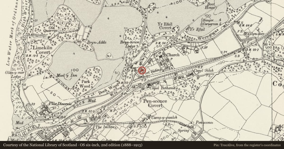
Slide toward Today to fade the historical sheet and see the modern map underneath.
David Rumsey Map Collection, Stanford LibrariesDavid Rumsey Map Collection, Stanford LibrariesDavid Rumsey Map Collection, Stanford LibrariesDavid Rumsey Map Collection, Stanford LibrariesDavid Rumsey Map Collection, Stanford Libraries
5 historical maps cover this location, the earliest the 1896 map "Sheet 7. Ordnance Survey of England and Wales." (David Rumsey Map Collection, Stanford Libraries).
Historical maps covering this location
- 1896 · Sheet 7. Ordnance Survey of England and Wales. (David Rumsey Map Collection, Stanford Libraries)
- 1899 · 106 Bangor (Outline) (David Rumsey Map Collection, Stanford Libraries)
- 1899 · 106 Bangor (Hills) (David Rumsey Map Collection, Stanford Libraries)
- 1901 · Sheet 9 and 10. (David Rumsey Map Collection, Stanford Libraries)
- 1919 · Sheet 41. Anglesey. (David Rumsey Map Collection, Stanford Libraries)
Cadw's description
Location
Situated at the NE end of Y Felinheli in the Aber Pwll area. On the SE side of the former A487, some 50m NE of the bridge over the disused Bangor to Caernarvon railway line.
History
One of a row of five Vaynol estate cottages, probably of c1863.
Exterior
Plain bargeboards to right pair of porches (Nos 1 & 2).
Reason for designation
The best example of the simpler Vaynol estate cottage groups.
Nearby in the register
- Cae GlasDomesticunder 1 mi
- Cae GlasDomesticunder 1 mi
- Cae GlasDomesticunder 1 mi
- Cae GlasDomesticunder 1 mi
Other entries of the same register within about three miles of this one, by straight line.